Hello dear.
Moscow is an ancient city. And very difficult from any point of view. Including in relation to various complex, unusual and one might say anomalous and mystical zones. And given the size of the Mother See, you can guess how many of these "difficult territories" there are. Let's recall just a few of them today.
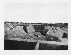
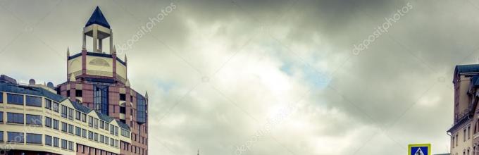
We will not touch on territories where there are many ghosts, such as Igumnov's House, Pashkov's House or Myasnitskaya 17, we will not dwell on the Akterkin ponds and the whole of Ostankino in general, we will skip the numerous objects associated with Jacob Bruce (this is what Muscovites were apparently terrified of - until now remember), do not remember the damned paintings of the Tretyakov Gallery, or the terrible dungeons of Khitrovka, the grave of Fyodor Gaz and the Patriarch's Ponds.
Jacob Bruce
Let's talk about several zones, it is not possible to determine whether they are completely positive or not. I call such territories "places of power" and in them even I, a person definitely weakly sensitive to external influences and flows of energy, plus being skeptical of such things, feel a little differently. Sometimes it is very good, and sometimes the other way around. Depending on the location. I will roughly indicate my feelings about these territories, and they may differ from yours :-)
So...
Voices ravine in Kolomenskoye Park.
It divides the museum-reserve into two equal parts. The ravine with steep slopes in Kolomenskoye is more than a kilometer long. To go down into it, you have to walk along long wooden stairs. It is believed that Golosov (formerly Volosov, Velesov), the ravine has the power of the pagan god Veles, who patronized material wealth. In the ravine itself, stretching from the Moskva River to Andropov Avenue, there are ancient (apparently sacred) stones: Goose-stone and Devin stone. They supposedly served as altars to this deity. Some researchers are sure that the ravine is a preserved relief of the seabed.
In the local "voice ravine", according to legend, George the Victorious fought with a snake. Where the hero's horse burst into the ground with its hooves, the springs began to flow, and the remains of the reptile were preserved in the form of huge magical boulders protruding from the ground. They also say that time lapses happen here - supposedly people disappeared in these places and returned only decades later.
To me, in principle, this place seems right and good.
Bypass channel in the very center of Moscow. It was laid from the Kremlin along the Moskva River in the 18th century, and was supposed to protect the city during floods and floods.
Never felt any uneasiness or inconvenience there. Especially on Balchug? I always feel discomfort there and try to bypass it. 
The workers who built it told the legend about a sorcerer sacrificed by the Swedes - they say, the place is damned, nothing can be built here. But the Obvodny Canal with ten bridges still appeared. Since the end of the 19th century, suicides began to occur in one of its sections: the unfortunate threw themselves into the water. In the 1920s, during underground construction work in the canal area, granite slabs with incomprehensible texts were discovered.
I don’t know about the lyrics, but the place is really strange and IMHO, dark
Museum-reserve "Tsaritsyno"
About five hundred years ago, here, among the centuries-old dense forests, there was a small village "Black mud", which got its name from the nearby healing springs and mud. If you smear yourself with a greasy, dark slurry, and then take a dip in a spring gushing out from under the ground, many ailments will be removed like a hand, the locals believed. After some time, the spring was consecrated, and pilgrims, including from the surrounding nobles and service people, reached out to it. 
Soon the rumor about the miraculous properties of water and mud reached Moscow, not passing by the grand ducal mansion in the Kremlin. That is why Catherine the Great, who is losing her beauty and youth, chose this place to build her palace. For some reason, Tsaritsino is considered a dangerous place. Particularly strong is the area under the main palace and under the bridges. But personally, I think the park is peaceful and positive. For me he is very, very good.
But lefortovo parki try to avoid 
It was created on the model of the famous Versailles Park, so contemporaries also called it "Versailles on the Yauza". In 1722, Peter I acquired the estate with the intention of making it his Moscow residence and remaking the park in the Dutch style. Next year, by his order, Nikolai Bidloo began to equip the park, decorating it with sculptures, dams, cascades and other decorations. At this time, a huge amount of earthwork is being carried out in the park, the directions of the flow of streams change, and symmetrical paths appear.
In 1730, celebrations of the coronation of Anna Ioannovna were held at the Lefortovo residence. The Empress proclaims Lefortovo her main Moscow residence and renames it in the German manner “Annenhof”. There is a legend that the "Annenhof Grove" appeared in the park overnight, when, at the whim of Anna Ioannovna, mature trees were brought in and planted.
There was always some devilry going on in this park. The palaces were constantly burning. In 1904, he suffered greatly from a tornado. Legends associate this with the grave of Franz Lefort himself, who was buried somewhere in the park. And although this is a legend without foundation, the place is so ... peculiar. It doesn't work very well for me personally.
AND estate Kuskovo very, very good. This is the former estate of the Sheremetevs counts, where the architectural and artistic ensemble of the 18th century has been preserved. Located in the east of Moscow in the Veshnyaki district. 
Kuskovo was first mentioned at the end of the 16th century and already as the possession of the Sheremetevs. In 1623-1624, a wooden church, a boyar courtyard, and serfs' courtyards stood here. Kuskovo remained in the possession of the Sheremetevs for more than three hundred years, until 1917.
Initially, in this area, the Sheremetevs owned only one small plot, a "piece", as Count Boris Petrovich Sheremetev called it. At the same time, all other lands in the district belonged to the future State Chancellor Alexei Mikhailovich Cherkassky. After the marriage of the son of Boris Petrovich, Count Peter Borisovich, with the only daughter of Prince Alexei Mikhailovich - Varenka, the Sheremetevs became the sole owners of these lands.
In the 1750s and 1770s, by order of Pyotr Sheremetev, an extensive estate with a palace, many "entertainment ventures", a large park and ponds was created in Kuskovo. The creation of this ensemble is closely related to the names of the serf architects Fyodor Argunov and Alexei Mironov. The architectural complex was created in the baroque-rocaille style of the middle of the 18th century.
Nice and beautiful place.
Finally, a rather strange place is the so-called Petrovskaya Gora in Tushino. Here in the XIV century. on the top of the Old Mountain (as it was called before) there was the Spaso-Preobrazhensky Monastery. But now there are no ruins left of it.
According to legend, this place is cursed. Somehow, they say, the merchants knocked at the gate of the monastery, fearing thieves, asked to let them stay for the night. However, the monks refused.
They say that the merchants stood at the gates for a long time, begging them to be admitted. But the inhabitants of the monastery remained adamant. Finally, the merchants drove home. After some time, the monks felt ashamed that they had treated good people in this way, and the abbot sent messengers after them. However, it was too late. Robbers attacked the merchants not far from the monastery. The next morning, their messengers from the monastery found them in a nearby grove "beaten and without goods."
All were killed by robbers, only one of the merchants was still alive. When he saw the monks, he whispered in his hearts: "Let your monastery fail!"
Since then, the Old Mountain began to sink. The Spaso-Preobrazhensky Monastery soon turned into ruins, and then whatever they tried to build, everything collapsed. Once upon a time there was also the residence of False Dmitry II, better known as the Tushinsky thief. And there were no traces of her. 
False Dmitry II
When soviet power local residents tried to plant vegetable gardens here. But everything failed ...
Today, a large pit is seen at the top of the mountain, similar to a meteorite crater. But no meteorite has ever flown here. It's just a "failure" place. I don't know what about the merchant curse, but the place is really weird. Very, very much.
Something like this.
What kind of places do you know in Moscow?
Have a nice time of the day.
Today we will go for a walk to the north-west of the capital, where there is one historical landmark - the Bratsevo estate. The Bratsevo estate is located at 13 Svetlogorskiy proezd (buses and minibuses run from the Skhodnenskaya and Planernaya metro stations) - an architectural monument and garden and park art.
We enter the estate from Salome Neris Street. The territory of the estate was designed according to the canons of an English regular park. Its green alleys and shady paths, the layout itself remind of 19th century English romanticism.

Stone bridge at the entrance to the estate

In fact, the park area around the estate is not landscaped, everything is "natural" here. Parents come here to walk with strollers, and pensioners walk along the paths

Young artists paint the Bratsevo estate

The romantic history of the early 20th century is associated with the Bratsevo estate. Count A. Stroganov married Ekaterina Trubetskoy. It was his second marriage, and it ended in disaster - almost immediately after the birth of their joint child, the Countess passionately fell in love with Adjutant General Rimsky-Korsakov, who was a retired favorite of Catherine II herself. He was an outstanding person, but the countess was famous not only for her beauty, she was very smart and extraordinary, and the gallant adjutant general was also seriously carried away by her. The romance flared up with such force that the countess makes a decision, despite the condemnation of the world, to leave her husband and go to her beloved. In those years it was a courageous act, but Count Stroganov also behaved very nobly. He did not take revenge on Catherine, let his wife go and even gave her the Bratsevo estate so that she could live there away from the world. There she lived with her common-law husband until her death.
The last owner of the Brattsevo estate was N. Shcherbatov, who handed it over to the state after the revolution. The only thing he asked for was the status of a cultural and historical monument for the estate, so that a unique place for posterity could be preserved.

A.N. Voronikhin is called the architect of the estate in many publications, who worked mainly on the orders of the Stroganovs. In support of his authorship, it is indicated that the main round hall of the house, with columns and a small staircase to the choir, resembles the Mineral Cabinet of the Stroganov Palace in St. Petersburg, built with the participation of Voronikhin. A two-story building has survived to this day. main house (cruciform, with a portico and crowned with a belvedere with a dome)

The main house of the Bratsevo estate

The estate is located on the top of a picturesque hill gently sloping down to the Skhodnya river valley.

At the bottom of the hill, locals love to relax in nature (they cook barbecue, play volleyball, badminton, just sunbathe)

Mitinski skyscrapers are visible from the hill

Shady alleys of Bratsevo park

The main entrance of the main house of the Bratsevo estate

In Bratsevo, the shooting of the famous television series "Poor Nastya", the films "Say a Word about the Poor Hussar" and "The Young Peasant Woman" took place.

Fountain square with benches near the main house of the estate, although the fountain does not work

Alley leading to the main house of the estate

A two-story wooden summer house with speakers, which served as a guest house, has survived to this day.

The most notable structure of the manor's household yard is the water tower, built on an artesian well in 1898

Former stables and carriage-repair sheds, now there is a banquet hall, where celebrations and weddings are celebrated

This is how the Moscow estate Bratsevo looks like next to the Moscow Ring Road. Honestly, it makes no sense to go here from the other end of the city ...

Near the estate, across the road, there is a unique natural monument - the so-called "Skhodnensky bucket"

Skhodnenskaya (Tushinsky) bowl (ladle) is a natural monument, part of the Moscow natural park "Tushinsky".

Going down into the bowl is quite problematic, since the slopes are very steep, but you can walk a little and find a path for descent

The diameter of the "Bowl" along the edge of the slopes is up to 1 km, the depth is about 40 m, the area is about 75 hectares

The appearance of the bowl can be easily explained - it was washed by the Skhodnya River, which gave it its name

Skhodnensky bucket is an abandoned place, overgrown with trees and bushes, where you can rarely meet paths and people on them.

Bridge across the river Skhodnya

Fabrichny proezd passes across the bridge

The Tushino Evangelical Church is located behind the bridge.

Another bridge across the Skhodnya River (connects Pokhodny Proezd and Vasily Petushkov St.)

A place where fishermen like to gather


Here's a walk around the Bratsevo estate and the Skhodnensky bucket
The Tushinskaya bowl, better known as the Skhodnensky ladle, is one of the parts of a specially protected natural area of \u200b\u200bregional significance in the city of Moscow, the Tushinsky Natural and Historical Park.
In fact, when I lived in this area, it never occurred to anyone to call the bucket a bowl, and even more so, no one ever thought that he and other regional "greens" have the status of a Natural Historical Park.
We just knew that this huge wooded pit, along the bottom of which the Skhodnya River flows, is a natural monument, and we were always amazed at its size: I can't say for sure, but they really amaze the imagination. Thanks to this, the Skhodnensky bucket has become one of those places where you can feel yourself away from the city without leaving it.
It is surrounded by residential buildings on all sides: the area, although a suburban one, has been developed for a long time, and this is even surprising - given the pace and customs of our modern life, it is strange that it has not yet yielded to the developers and retained its almost wild appearance.

It is noteworthy that the slopes, although not very steep, are quite difficult to descend along them. You still need to find the path, and after that - try not to lose the grass in the thickets :) I climbed down repeatedly, but today I still fell several times, because the slates turned out to be far from the best shoes for such a walk - sneakers or any other shoes would be much more suitable , which is not a pity.
By the way, regarding the appearance of the bucket in the form in which we can observe it now (a huge pit), there is a very interesting legend about which I once heard from friends. Legend has it that there used to be a hill on the top of which a temple stood. A road passed by the temple, and one time, late in the evening, merchants walked along it, who asked to stay overnight in the temple, but they were not allowed.
The merchants had to move on, but at night they were attacked by robbers and killed all except one, who miraculously managed to escape. You, of course, have already guessed what the merchant wanted the temple? That's right, fail.
The place is considered "bad" - in Soviet times they tried many times to adapt it for any needs, but the attempts were unsuccessful. And the plots were distributed, and they wanted to flood - but in the end there are no dachas or a reservoir there.
It is believed that one of the "coolest" geopathogenic zones in Moscow is located here.
However, you can't say anything about the local flora :) The landscapes are quite typical for the "countryside" (but don't forget that we are not in it!) - there are, for example, meadows and meadows.


On one of the glades, I finally came across a more or less civilized path, along which I went further.
In addition to the "usual" trees and grass, sea buckthorn also grows in the bucket, which has become a novelty for the city residents. If you were sure that sea buckthorn is such an intricate sexual position - welcome! 
And there are plenty of wildflowers, which you simply cannot see in the city.

But the most interesting thing here is the atmosphere. Sometimes you really forget that you are within the city - only the noise of Moscow roads and other city sounds reminds of this.
Not only people, but also animals are in solidarity with this opinion - there is evidence that hares, squirrels, foxes and weasels are found in the bucket, as well as large (hawks, falcons and woodpeckers) and small birds, including the Red Book, nest. On an information plate near one of the slopes it is written that this is the only place in Moscow where nests of snipe and meadow pipits have recently been seen.


The path I found soon led me to the Skhodnya River. Its shores are a favorite place for vacationers and local fishermen, therefore, almost all "civilized" paths sooner or later come to it.
Not surprisingly, the area along the river looks much more "habitable" than the rest of the bucket area.
Dear Hamster members!
Each of you knows about a very interesting and unique corner of nature in Tushino, and maybe even in Moscow - Skhodnensky bucket. Some call it the Skhodnenskaya (Tushinskaya) bowl or the Skhodnenskaya floodplain. This natural object received such a name in connection with its relief form, which is directly opposite to the mountain one, namely, depressions, i.e. depressions towards the center and raised edges. Moreover, the bucket is deep enough - it goes down almost 40 meters. A lot of interesting facts it is described in the corresponding topic. Some of them I learned from personal observations, others - here on the Hamster, others - from the stories of my grandmother or from old photographs on Oldmoss. Since 1991, the Kovsh has been a specially protected natural area, and since 1998 it has been a natural monument and part of the Tushinsky natural-historical park.
The bucket is located in the South Tushino area, extending from north to south from the former village of Petrovo to the former Knitting Factory, and from west to east - from Svetlogorsk passage to Donelaitis passage. In the southern part of the Kovsh there is the Skhodnya river bed, which makes a sharp turn there, on the map - as if in the shape of a horseshoe or a bagel.
According to Wikipedia, "the bowl was formed in the post-glacial period, when the more full-flowing Skidnya flowed at the present upper edge of the cliff. Over time, the riverbed deepened, retreating southward under pressure from bedrocks, until the somewhat shallow river ended up at the bottom of the gully."
In this article I would like to talk about how the Bucket looks like in winter. As in any other season, it is beautiful and you can admire it endlessly. I do not know of such other unusual place. So I decided to walk recently, on December 18, along the slopes of the Skhodnensky bucket and admire its beauty and wide expanses. My route ran from the observation deck at Svetlogorsk passage to the former Tushinskaya knitwear factory.
Thus, I went from the place where the routes along the Bucket usually start, approximately opposite the school 821 and the former First Workers' Town, near house 47 along Jan Rainis Boulevard. From this point, beautiful views of the Bucket open up and it is often photographed from there. Once upon a time, in the 1980s, a ski drag lift was located near that place, according to eyewitnesses referring to the ski club "Omega", there was a corresponding sign. The lift was collapsible and stood all winter. I can't say for sure whether the beginners trained there or only the professionals skated. Rather the latter, as the slope in the northwestern part is quite steep. The remains of the booth have not survived, since this place turned out to be under the asphalt when the Svetlogorsk passage was expanded.
In addition, from that place in the 1970s and 80s. hang gliders started, again professionals who could catch the direction of the wind and without takeoff with the help of a dynamic flow took off upward.
Now I present to you the beautiful and breathtaking winter views of the snow-covered Bucket from the observation deck:
As you can see, in recent decades, the Bucket is gradually overgrown with trees, primarily American maple. But this does not diminish its natural beauty, its richness with vegetation also has its own unique look. Previously, the Bucket was more "bald", almost without trees and bushes, and in the 1990s. In times of crisis, vegetable gardens were often planted on the slopes of the Bucket - they planted potatoes and other vegetables. The most persistent kept vegetable gardens until the early 2000s.
What wonderful views open up to our native Skhodnensky ladle from the north-western slope!
In the background of the photo you can see the residential quarters along Donelaitis Avenue on the opposite slope, on the right - house 14 along Donelaitis near the Knitting Factory. In the center, one can see the pipes of the regional thermal station "Tushino-4" along Fabritius, and even further - high-rise buildings along Lodochnaya. If you look to the right, you can see the skyscrapers on Shchukinskaya and behind them - the Triumph-Palace. In good clear weather from the Kovsh you can also see the Moscow State University named after M.V. Lomonosov.
I also photographed the northern slope of the Bucket. It is also steep, but not as steep as the northwest one. You still need to go to it. In the background, you can see the blocks along Jan Rainis (3rd microdistrict of Skhodnenskaya floodplain, the former village of Petrovo) and along Donelaitis:

Then I went towards the former village of Petrovo and approximately along the Jan Rainis boulevard. A magnificent panorama of this natural monument stretched out in front of me, the western slope of the Bucket appeared on the right in the photo. It is the steepest, almost abrupt, and at the same time the most overgrown. Even earlier, in the 1980s and 90s, there was always vegetation on it, unlike other slopes in the 1980s. To the right of it passes the Svetlogorsk passage - a motorway, so you can't really walk there and practically won't see the Bucket because of the abundant vegetation.

The view in the background of the photo also appears to have changed. Now house 14 on Donelaitis is in the center, and to the right of it you can see the yellow (new) and red (old) hostels of the Knitwear Factory, to the right of their yellow building behind the trees is the factory itself. In the rightmost part of the photo you can see the high building of the tax office in Tushino, a little to the left - the Olympia LCD in Strogino, even to the left and completely in the background - the skyscraper of the Continental LCD in Khoroshevo-Mnevniki. If I am not mistaken, in the center, in the very background, you can see the radio and television mast of the October Radio Center (OKTOD). Here, it turns out, how many interesting things you can see from the Bucket, in addition to the Bucket itself! A real observation deck, as if "Tushinskie Vorobyovy Gory"!
And I went further and continued to photograph, and now we see a perspective similar to the first photograph, only the houses have become a little closer. The tree in the foreground (I think it's ash) adds sophistication to the photo. In the Bucket itself, we see places that are not yet so overgrown and remind us of the 80s, and our native Russian birches:

Now there is a view of the Knitting Factory and the Tax Office, and trees are also in the foreground. On the right side of the photo, behind a tree, there are residential quarters of the 3rd microdistrict of the Skhodnenskaya floodplain, built in the early 1990s:

And now we can see not only the 3rd microdistrict, but also the 4th microdistrict of the Skhodnenskaya floodplain with new high-rises, i.e. the former First Workers' Town, more than half of whose houses were demolished in the late 1990s. It is also clearly seen here that the western part of the Bucket is the most overgrown, and on the right side of the photo a more "bald" slope is drawn, possibly remaining from the ski slope near the former Omega lift:

After that, if we look at the map, we find ourselves in a small "bay" of the Bucket, namely in the place from which they used to often love to ride on sleds, especially longitudinal ones. In the 1970s - early 1980s, when the village of Petrovo was still there, the hill on this slope, on which sledges gathered, was popularly called "Petrovka". In other words, this is the northern slope of the Bucket. It was he who was most popular, and not only among toboggans, but also among hang gliders. So many people gathered on it that it was easy to collide with each other. The last ones on this slope were also the most convenient, since it is not very steep and it was possible to scatter on it, in order to then take off upward, catching the south wind. Oldmoss has many old photographs of sleds and hang gliders gathering on the northern slope. Slightly to the west of the northern slope, approximately in the area of \u200b\u200bhouse 43 on Jan Rainis, there was another ski lift - "Hydroproject", but much less information about it has survived. Unlike "Omega", it worked mostly only on weekends, and the cable was pulled to it every time, and every time they removed, they carried a yoke with them. The lift worked from 1978 to about 1983, before the demolition of the village of Petrovo.
This slope is still not overgrown with vegetation, at least a part of it is closer to the edge of the Bucket, and the kids still ride there, now not only on sledges, but also on ice, snow-scooters and tubing. Despite the fact that in the center there is a sign "No Riding". Everyone follows tradition. And I remember that I rode down small hills when I was little, but I was afraid to go further into the depths - as if not to fall. And then, in the 90s, the Bucket was not yet so overgrown. It can be seen that the slope is now "empty", only a lone tree stands in the middle:

In the place where the kids are now skating, at the peak of the popularity of "Petrovka" among the sledges there was an ice slide, popularly called "Bobsleigh", quite dangerous. People who had already gained a fair amount of experience in sledding from "Petrovka", moved down this hill and flew at full speed down into a liquid, viscous muddy swamp deep in the Bucket, and already in front of it, so as not to get into it, they tried to brake. Now you can see that the children slide down to the place of the northern slope, on which the first vegetation begins:

It can be seen that the former "Petrovka" is still popular among the people, although not as much as before:

If you turn towards the Bucket itself, you can see that a little to the right after the "bald spot" the Bucket breaks off, and there is already vegetation below. In the background, the same perspective is visible - Tricotazhka and the 3rd microdistrict of the Skhodnenskaya floodplain:

And we move further along the former village of Petrovo. And now we pass on the edge of the northeastern slope, steeper and more overgrown with vegetation than the northern one. Earlier, in the 1970s and 80s, some trees also grew on it, in contrast to the northern slope. And, besides, this slope was not knurled, there were very rare cases when someone skated from it. There were also accidents. At the same time, this slope is not as overgrown as the western one, and from it you can still see the perspective of the Skhodnensky ladle. Unlike the western slope, trees grow only in depth, and on the surface of the trees there are no:

Now in the background in the center is the tax office, on the left is the Knitting Factory and the southern part of Donelaitis, and on the right is the 3rd microdistrict of the Skhodnenskaya Poima.
We turn a little back and now we see the same northern slope, which is popular with sledders. Obviously, this place immediately stands out among the Skhodnensky bucket with a pronounced slide for riding:

We go further and slowly approach the residential areas of Donelaitis passage, i.e. to the eastern part of the Bucket. It is arranged differently, in contrast to the northern one: there the slope is even less steep, but there is a lot of vegetation. The bucket has a not too high mountain there, while it is strongly elongated in the horizontal relief. There are many trees in the foreground, and in the background, on the right, house 47 on Rainis now appears, where we started our walk:

But we go even further, go out onto the sidewalk at the very carriageway of Donelaitis, and the houses are all moving away from us. It can be seen that in this place the Bucket does not go down so well, so you can not see it so well, but the views are still very beautiful. Somewhere a strongly inclined tree "got lost". Once upon a time there was an old dump of rusty things and a trolleybus that no one needed was lying, later lowered from the slope to the Skhodnya River. The slope, however, is even more gentle here:

Now we come to the southeastern part of the Bucket, in the area of \u200b\u200bhouse 14 on Donelaitis. The slope is practically gone, the relief is almost flat, but in the background there is now a good view of the quarters along Jan Rainis on the site of the former village of Petrovo and to the northern slope. Here you can see that there is a lot of vegetation in the central part of the Bucket:

It can be seen that the first houses are already far away, but it seemed to me that when I was filming from the northern slope, house 14 seemed to be even further away. Interesting sensation, optical illusion ...
And now we have almost come to the Knitting Factory. We go down from the Donelaitis passage along a small path down to the passage between the hostel and the factory itself, then we find ourselves on the pedestrian bridge over the Skhodnya river. It always seemed to me that this place had some kind of its own atmosphere, as if it were Soviet, and that you feel yourself there not at all in Moscow, but as if in a small town near Moscow or even far in the provinces. Now, unfortunately, the factory is no longer working (since 2004), the premises in it are leased for offices. But walking there is still nice, as if you are remembering your childhood. We can see the pipeline across the Skhodnya, sometimes used as a pedestrian bridge. However, before there really was a pedestrian bridge. And even further - a dam across Skhodnya. On the left is the yellow building of the former factory, which was built before the revolution, in 1905:

Now let's turn in the opposite direction and see on the right the old brick building of the hostel of the Knitting Factory, in which a major overhaul was recently carried out with the replacement of floors. Behind it is a small yellow building, a new dormitory building:

And now we come to the dam itself. It is interesting to observe and listen to how the water is rustling in the dam below, in the Skhodnya river:

Finally, one more time - close-up of the factory building:

And at the end of our walk we find ourselves at the Trud stadium, previously owned by the Tushino knitwear factory. It is now used as a field for training and rugby games. Previously, there were often held not only sports competitions between workshops, but also cultural events. In fact, this stadium is adjacent to the Skhodnensky bucket. In the background, we can again see the 2nd microdistrict of the Skhodnenskaya floodplain on the site of the former village of Petrovo. I apologize for the quality of the photos, as it was already getting dark at that time:

See you at the Tushinskiy Khomyak! See you!
Discussion of the post on the forum16 comments,
Used only own photos - date of shooting 06/15/2013
The address: Moscow, Svetlogorsky prospect, metro "Skhodnenskaya".
How to get there: from metro Skhodnenskaya 1.7 km, bus 43,212,267, march 643m, 702m, 570,878,492,176m, 267m, 537,370m, trolley 70k, 70 to the stop. "Boulevard Jan Rainis, 20"
Near the Brattsevo estate and the now demolished village of Petrovo, in the bend of the Skhodnya there is a natural monument, the so-called "Skhodnensky ladle" (otherwise "Skhodnensky bowl") - a gigantic depression of unknown origin, 40 m deep. The bowl has an ideal round shape, and is itself filled soils.
The Skhodnya Valley immediately south of Bratsevo has been quite densely populated since ancient times, as evidenced by the Finno-Ugric settlements of the early Iron Age (Dyakovo culture, the turn of our era): Tushinskoe near the Skhodnenskaya bowl and two Spas-Tushinsky settlements behind the Savior.
Skhodnenskaya (Tushinskaya) bowl (ladle) is a natural monument, part of the Moscow natural park "Tushinsky". The bowl is an amphitheater with landslide relief around the swampy floodplain of the Skhodnya River.
On three sides, the "Bowl" is bounded by high steep banks, in the southern part there is a loop of the Skhodnya river channel. The diameter of the "Bowl" along the edge of the slopes is up to 1 km, the depth is about 40 m, the area is about 75 hectares.
The bowl was formed in the post-glacial period, when the more full-flowing Skhodnya River flowed at the present upper edge of the cliff. Over time, the riverbed deepened, retreating in a southerly direction under the pressure of bedrocks, until a somewhat shallow river appeared at the bottom of the ravine.
In the floodplain there is a vast sedge-cattail bog. At the end of the XX century. on the territory of the bowl, one could find the following species of animals listed in the Red Book of Moscow: sharp-faced frog, common newt, viviparous lizard, common snake, weasel, hare; birds - snipe, moorhen, meadow pipit. In 2004, hares and weasels could no longer be found.
View from Mount Petrovka to the Skhodnenskaya bowl |
 |
 |
 |
 Swamp at the bottom of the Skhodnenskaya bowl |
 |
 |