It occupies an area of about 7 million square kilometers. Eastern Siberia is the region located east of, to the mountains that form the watershed between and. Occupies the largest area. In the north and east there are two lowlands: North Siberian and Central Yakut. In the south and west there are mountains (Yenisei Ridge). The length of this region from north to south is about 3 thousand kilometers. In the south is the border with and, and the northernmost point is Cape Chelyuskin.
During the Mesozoic period, most of Central Siberia experienced uplift. It is no coincidence that it is in this area that the most high point Central Siberian Plateau - (its height is 1700 meters above sea level). During the Cenozoic, the surface uplift continued. At the same time, a river network was being created on the surface. In addition to the Putorana plateau, the Byrranga, Anabar and Yenisei massifs rose most intensively. Subsequently, active tectonic processes that occurred in this territory led to changes in the river system. Traces of river systems that existed in ancient times have survived to this day. At the same time, river terraces and deep river valleys in the central part of Siberia were formed.

Cape Chelyuskin
The vast majority of river valleys in Central Siberia are canyon-shaped and asymmetrical. Their characteristic feature is also large number terraces (six to nine), which indicates repeated tectonic uplifts of the territory. The height of some terraces reaches 180-250 m. In and in the North Siberian Lowland, the river valleys are younger, and the number of terraces is somewhat smaller. Even the largest rivers have three or four terraces here.
On the territory of the Central Siberian Plateau, four relief groups can be distinguished:
- plateaus, ridges, plateaus, ridges, and mid-mountain massifs on the ledges of the crystalline basement
- stratal hills and plateaus on sedimentary Paleozoic rocks;
- plateau
- and reservoir-accumulative
Most of the tectonic processes that took place in ancient and modern times, in the territory Eastern Siberia coincided in their focus. However, this did not happen throughout the entire territory of the Central Siberian Plateau. As a result of these inconsistencies, depressions similar to the Tunguska were formed. There is no permafrost (Lena-Angarsk and Leno-Aldan plateaus). But the main small relief forms on the territory of the Central Siberian Plateau are still erosional and cryogenic.
Due to the strong continental monsoons characteristic of Eastern Siberia, here you can find a large number of rocky placers and screes in mountain ranges, on the slopes of river valleys and on plateau surfaces.
The hydrographic network of Eastern Siberia belongs to the Arctic Ocean basin and is distributed over the private basins of the Kara, Laptev, East Siberian and Chukchi seas. According to the nature of the relief Eastern Siberia refers to mountainous regions, where medium-height mountains and extensive plateaus predominate, while lowlands occupy only small spaces.
Between the Yenisei and Lena lies the Siberian Plateau, dissected by erosion. Its height is on average 300-500 m above sea level; Only in some places higher elevations stand out among the plateau - the Putorana Ridge (1500 m), the Vilyui Mountains (1074 m) and the Yenisei Ridge (1122 m). The Sayano-Baikal folded country is located in the upper part of the Yenisei basin. This is the most high-mountainous area of the region, with altitudes up to 3480 m (peak Munku-Sardyk).
To the east of the lower reaches of the Lena stretches the Verkhoyansk-Kolyma mountainous country, characterized by sharp contrasts of lowland and mountain landscapes. Along the right bank of the Lena stretches a powerful arc of the Verkhoyansk ridge with heights of up to 2000 m, then to the east rises the Chersky ridge - a mountain node with a height of 2000-3000 m, the Tas-Khayakhtakh ridge, etc. Along with the mountain ranges, the Verkhoyansk-Kolyma mountain region includes Oymyakon, Nerskoe and Yukagir plateaus. In the south, the border of the region is formed by the Yablonovy, Stanovoy and Duzhgdzhur ridges, whose heights reach 2500-3000 m. In the east, the Kolyma Range, or Gydan, stretches along the coast of the Sea of Okhotsk.
On the territory of Eastern Siberia there are also lowland plains, among which the Leno-Vilyuiskaya lowland, which is a grandiose synclinal trough, stands out for its size. The extreme north of the region, along the coast of the marginal seas, is occupied by the Subpolar Sea Lowland, the height of which does not exceed 100 m above sea level; lowlands are also located in the lower reaches of Alazeya, Kolyma and Indigirka.
The subpolar lowland is occupied by tundra and forest-tundra. Most of the territory of Eastern Siberia belongs to the taiga zone. The forest landscape is dominated by Dahurian larch, which is most adapted to the harsh climate and the presence permafrost; There are significantly fewer pine trees here. The forests of Eastern Siberia are slightly swamped.
The taiga zone in Eastern Siberia is dominant and extends far to the south; areas of steppe and forest-steppe are interspersed with it in the form of spots (Minusinsk Basin, which has a steppe character, the steppes of Transbaikalia).
Geologically, the area is characterized by shallow bedrock of crystalline rocks, which often come to the surface here. Ancient igneous rocks - traps - are widespread, especially within the Central Siberian Plateau, forming characteristic vertical outcrops in the form of columnar units (locally called pillars) along river valleys.
The rivers of Eastern Siberia predominantly have the form of mountain streams; flowing through the lowlands, they acquire a flat character.
EASTERN SIBERIA, a natural region located primarily in Russia. It is located in Siberia, between the Yenisei River valley and the watershed ridges along the Pacific coast, stretching south of the Chukotka Peninsula. In the north it is washed by the Kara, Laptev and East Siberian seas.
The naturally complex Eastern Siberia includes the following physical and geographical countries: Central Siberia, partly the Altai-Sayan country (with the Eastern Sayan mountain system), North-Eastern Siberia, the Baikal region and Transbaikalia. The relief is dominated by low and middle mountains. In the west, the largest Central Siberian Plateau in Russia stands out. In the east, complex mountain systems (Verkhoyansky, Chersky, etc. ridges) are combined with plateaus (Yanskoye, Elginskoye, Alazeyskoye, Yukagirskoye, etc.) and highlands (Oymyakonskoye, Kolymskoye, etc.). In the south there are also a number of vast highlands (Stanovoye, Aldanskoye, Patomskoye, etc.). In some high mountain ranges, alpine landforms with modern glaciation are developed (Orulgan, Momsky, Sunta-Hayata, etc.). In the north there are a number of large lowlands - North Siberian, Yana-Indigirsk, Kolyma, etc.
The tectonic structures of Eastern Siberia are represented by the Siberian Platform and its folded framing: in the north - the Early Mesozoic structure of Taimyr; in the west - the Yenisei ridge system of Baikal age; in the southeast - the structures of the Salair-Caledonian-Hercynian Altai-Sayan folded region. In the south is the Baikal-Mongol-Okhotsk region, in which the time of main folding in various mountain systems varies from the late Proterozoic to the late Mesozoic. To the east of the Siberian Platform is the Late Mesozoic Verkhoyansk-Chukotka folded region. In the Cenozoic, the southern part of Eastern Siberia was affected by mountain building. The eastern regions are experiencing active uplift. In the south of Eastern Siberia there is one of the largest continental rift systems in the world - the Baikal Rift System. High seismicity is typical for the southern (the depression of Lake Baikal with adjacent territories, the Eastern Sayan) and eastern (Verkhoyansk, Chersky ridges) regions. Strong destructive earthquakes occurred in 1862 (in the delta of the Selenga River), 1927 (Bulunsky in the Verkhoyansk Range), 1950 (in the Eastern Sayan), 1957 (Muyskoye in Transbaikalia), 1959 (Middle Baikal), 1971 (Artykskoye in the Chersky Range). There are known deposits of oil and natural combustible gas, coal, ores of iron, gold, uranium, platinum, tin, copper, nickel, cobalt, antimony, mercury, niobium, rare earth elements, as well as diamonds, phlogopite, muscovite, asbestos, stone and potassium salts etc.
The climate of Eastern Siberia is sharply continental. In the areas of Oymyakon and Verkhoyansk there is the pole of cold of Eurasia (absolute minimum -68 °C). Permafrost is widespread everywhere, reaching a maximum thickness of 1500 m (Markha River basin). There are numerous thermokarst lakes in the north and northeast. The rivers flow through the territory of Eastern Siberia largest rivers Russia: Lena, Yenisei, Kolyma, Indigirka; There is a unique Lake Baikal. The northern lowlands of Eastern Siberia are occupied by tundras: arctic, moss-lichen and shrub on peat-cryozems. To the south, a narrow strip of forest-tundra without a sharp transition is replaced by the northern subzone of taiga larch forests on coarse humus cryozems. Larch forests are widespread in the middle and southern subzones of the taiga on cryoturbated pale soils and coarse humus light soils. In the south of the Central Siberian Plateau there are forest-steppe islands. The zonal distribution of soil and vegetation cover is disturbed in the Byrranga Mountains and on the Putorana Plateau, as well as in high areas of the plateaus. The structure of altitudinal zones in the northeastern part of Eastern Siberia differs sharply from the southern part, where it is more diverse.
Active development natural resources, development of large industrial centers led to the emergence of areas with a tense environmental situation (Norilsk, Kemerovo, Irkutsk, etc.), which is aggravated by poor ability natural environment this region towards self-purification. A number of nature reserves have been created (Taimyrsky, Barguzinsky, Central Siberian, Vitimsky, etc.) and national parks(Pribaikalsky, Transbaikalsky, Tunkinsky, etc.). The World Heritage List includes: Lake Baikal, Ubsunur Basin (most of it in Mongolia).
Lit.: Plains and mountains of Siberia. M., 1975; Antipova A.V. Geography of Russia. M., 2001.
Eastern Siberia occupies a vast territory from the Yenisei to Pacific Ocean. It is famous for its large number of natural resources and minerals. The features of the relief and this region made it so valuable in terms of raw materials. The mineral resources of Eastern Siberia are not only oil, coal and iron ores. A significant part of Russia's gold and diamonds, as well as valuable metals, is mined here. In addition, this region contains almost half of the country's forest resources.
Eastern Siberia
Minerals are not the only feature of this region. Eastern Siberia covers an area of more than 7 million square kilometers, which is about a quarter of all of Russia. It extends from the valley of the Yenisei River to the very mountain ranges on the Pacific coast. To the north, the region borders the Arctic Ocean, and to the south, Mongolia and China.
Not many regions belong to Eastern Siberia and settlements, as in the European part of Russia, because this area is considered sparsely populated. Here are the largest in terms of territory in the country, the Chita and Irkutsk regions, as well as the Krasnoyarsk and Transbaikal region. In addition, Eastern Siberia includes autonomous republics Yakutia, Tuva and Buryatia.

Eastern Siberia: relief and minerals
The diversity of the geological structure of this region explains such a wealth of its raw materials. Due to their huge number, many deposits have not even been explored. What mineral resources is Eastern Siberia rich in? This is not only coal, oil and iron ores. In the depths of the region lie rich reserves of nickel, lead, tin, aluminum and other metals, as well as sedimentary rocks necessary for industry. In addition, Eastern Siberia is the main supplier of gold and diamonds.
This can be explained by the features of the relief and geological structure of this region. Eastern Siberia is located on the ancient Siberian Platform. And most of the region’s territory is occupied by the Central Siberian Plateau, elevated above sea level from 500 to 1700 m. The foundation of this platform is the oldest crystalline rocks, the age of which reaches 4 million years. The next layer is sedimentary. It alternates with igneous rocks formed as a result of volcanic eruptions. Therefore, the relief of Eastern Siberia is folded and stepped. It contains many mountain ranges, plateaus, terraces, and deep river valleys.
Such a variety of geological processes, tectonic shifts, sedimentation of sedimentary and igneous rocks led to the wealth of mineral resources in Eastern Siberia. The table shows that more resources are mined here than in neighboring regions.

Coal reserves
Thanks to geological processes since the Paleozoic and Mesozoic eras, Russia's largest coal deposits of Western and Eastern Siberia are located in the lowlands of the region. These are the Lena and Tunguska basins. There are also a lot of smaller deposits. And although they contain less coal, they are also promising. These are the Kama-Achinsky and Kolyma-Indigirsky basins, the Irkutsk, Minusinsk, and South Yakutsk fields.
Coal reserves in Eastern Siberia account for 80% of all coal mined in Russia. But many of its locations are very difficult to develop due to the harsh climatic conditions of the region and the terrain.

Iron and copper ores
The main minerals of Eastern Siberia are metals. Their deposits are found in the most ancient rocks, dating back to the Precambrian period. Most of the region has hematites and magnetites. Their deposits are located in the south of the Yakut region, in the basin on the Angara, in Khakassia, Tuva and Transbaikalia.
The largest ore deposits are Korshunovskoye and Abakanskoye. There are also many of them in the Angaro-Pitsky region. 10% of all Russian reserves are concentrated here iron ore. In Transbaikalia and in the north of the region there are also large deposits of tin and valuable metals.
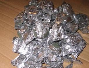
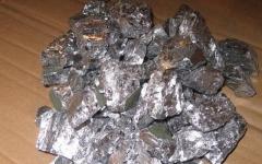
The surrounding area of Norilsk is famous for its large deposits of copper-nickel ores. Almost 40% of Russian copper and about 80% of nickel are mined here. In addition, there is a lot of cobalt, there is also platinum, silver, tellurium, selenium and other elements. Copper, mercury, manganese, and antimony are mined in other places. There are large deposits of bauxite.

Non-metallic minerals
Our country is the world's largest supplier of natural gas, and a lot of oil is produced here. And the first supplier of these minerals is the deposits of Eastern Siberia. In addition, geological processes have led to the emergence of rich deposits of sedimentary rocks.

Gold and diamonds of Eastern Siberia
The most valuable metal has been mined here for almost the second century. The oldest deposit is Bodaibo in Irkutsk region. There are rich placer and bedrock deposits of gold in the Aldan, Yan, and Allah-Yun regions. Deposits have recently begun to be developed in the area of the Yenisei Ridge, near Minussinsk and in the east of Transbaikalia.
Thanks to special geological processes that took place in this region back in the Mesozoic era, many diamonds are now mined here. The largest deposit in Russia is located in Western Yakutia. They are mined from so-called diatremes filled with kimberlites. Each such “explosion tube” in which diamonds are found even got its own name. The most famous are “Udachnaya-Vostochnaya”, “Mir” and “Aikhal”.

Natural resources
The region's complex terrain and vast undeveloped territories covered with taiga forests provide a wealth of natural resources. Due to the fact that the deepest rivers in Russia flow here, the region is provided with cheap and environmentally friendly hydroelectric power. The rivers are rich in fish, the surrounding forests are rich in fur-bearing animals, of which sable is especially valued. But due to the fact that people are increasingly interfering with nature, many species of plants and animals are becoming extinct. Therefore, many reserves and national parks have recently been created in the region to preserve natural wealth.

Richest areas
Eastern Siberia occupies almost a quarter of Russia's territory. But not many people live here. In some places there are more than 100 square kilometers per person. But Eastern Siberia is very rich in minerals and natural resources. Although they are unevenly distributed throughout the region.
- The richest in economically is the Yenisei basin. Krasnoyarsk is located here, where more than half of the total population of Eastern Siberia is concentrated. The wealth of this area in minerals, natural and hydro resources led to the active development of industry.
- The wealth located in the upper reaches of the Angara River began to be used only in the 20th century. A very large polymetallic deposit was discovered here. And the reserves of iron ore are simply huge. The best magnesite in Russia is mined here, as well as a lot of antimony, bauxite, nepheline, and shale. Deposits of clay, sand, talc and limestone are being developed.
- Evenkia has the richest resources. Here in the Tunguska basin there are such minerals of Eastern Siberia as stone and high-quality graphite is mined in the Noginskoye deposit. Iceland spar deposits are also being mined.
- Khakassia is another richest region. A quarter of East Siberian coal and all iron ore are mined here. After all, the Abakan mine, located in Khakassia, is the largest and oldest in the region. There is gold, copper, and a lot of building materials.
- One of the richest places in the country is Transbaikalia. Mainly metals are mined here. For example, it supplies copper ores, Ononskoye - tungsten, Sherlokogonskoye and Tarbaldzheyskoye - tin, and Shakhtaminskoye and Zhrikenskoye - molybdenum. In addition, a lot of gold is mined in Transbaikalia.
- Yakutia is a treasure trove of mineral resources in Eastern Siberia. Although only after the revolution, deposits of rock salt, coal and iron ore began to be developed. There are rich deposits of non-ferrous metals and mica. In addition, it is in Yakutia that the richest reserves of gold and diamonds have been discovered.

Problems of mineral development
The vast, often unexplored territories of the region lead to the fact that many of its natural resources not mastered. There is a very low population density here, which is why the promising mineral deposits of Eastern Siberia are mainly developed in populated areas. After all, the lack of roads over a large area and the enormous distance from the center contribute to the fact that the development of deposits in remote regions is unprofitable. In addition, most of Eastern Siberia is located in the permafrost zone. And the sharply continental climate prevents the development of natural resources in the rest of the territory.

Northeastern Siberia and Far East
Due to the terrain and climatic conditions, mineral resources in North-Eastern Siberia are not so rich. There are few forests here, mostly tundra and arctic deserts. Most of the territory is dominated by perpetual merlot and year-round low temperatures. Therefore, the mineral resources of North-Eastern Siberia are not very well developed. Mainly coal is mined here, as well as metals - tungsten, cobalt, tin, mercury, molybdenum and gold.
The easternmost and northern regions of Siberia are classified as the Far East. This area is also rich, but also more populated due to its proximity to the ocean and milder climate. Minerals of Eastern Siberia and Far East are similar in many ways. There are also a lot of diamonds, gold, tungsten and other non-ferrous metals; mercury, sulfur, graphite, and mica are mined. This region contains rich deposits of oil, coal and natural gas.