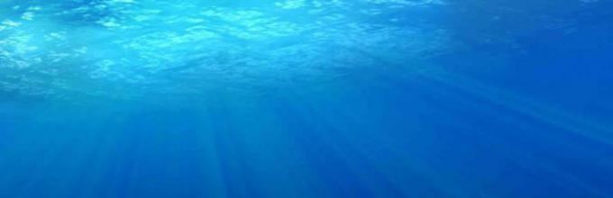
Ice-covered edge of the earth sparkling with cold light! The frozen peaks of countless islands float below in white silence. I have flown over the Franz Josef Land archipelago many times, walked on this land many times, but I still can’t get used to its majestic beauty.
The first to break the silence was the commander of our crew, Ivan Ivanovich Cherevichny. Looking up from the porthole, he asked:
Are there no such cracks on the dome of Rudolph Island? He pointed to the convex plateau of Rainer Island, the edges of which gaped with crevices.
It wasn’t in '37. “We’ll fly in and see,” I answered.
Fortunately, cracks form mainly at the edges of glaciers. Knowing this, you can choose a relatively safe landing site.
Soon the familiar outlines of Rudolf Island emerged in the soft purple shadows of the approaching dusk.
The four-engine USSR-N-169, which launched a day ago in Moscow, was heading to the area of the “pole of relative inaccessibility.”
North of the 75th parallel, between meridians 170° east and 130° west, lies a huge unexplored area of the Arctic Ocean.
The contours of this “white spot” form a triangle. Its top is adjacent to the geographic point of the pole, and not far from the center of the “spot” there is one of the remarkable places on the globe - the “pole of relative inaccessibility.”
Remote from the ocean shores, surrounded by multi-year ice impassable for icebreakers, this area has so far remained unexplored. The “pole of inaccessibility” hid a lot of tempting things. Scientists all over the world tried to guess what was going on there.
Some argued that this place is at the same time a “pole of lifelessness,” a dead, icy space. Others, on the contrary, argued that there were lands with rich wildlife there; they referred to B. Bartlett, who, moving along the drifting ice to Wrangel Island, observed flocks of birds flying from the north, apparently after the summer.
There have been attempts to penetrate to the “pole of relative inaccessibility.” The same captain Bartlett went here in 1913 in search of the supposed Harris Land, but his schooner was crushed by ice, and the crew, having lost several people, had difficulty getting out of trouble.
In 1927, polar explorer G. Wilkins and pilot B. Eielson reached 77° 46" north latitude and 175° 00" west longitude. In 1938, flying from an Alaska airfield, he reached 87° north latitude and examined the eastern border of the “white spot,” but he was unable to penetrate into the interior of the territory.
The Arctic jealously guarded its secrets.
In December 1940, I. Cherevichny, V. Chechin and I presented a project for an expedition to the Leningrad Arctic Institute to study the “pole of relative inaccessibility.” Scientists supported us.
It was planned to make three landings in the “white spot” area north of Wrangel Island and carry out a complex of scientific work.
The expedition, in addition to the team consisting of pilots I. Cherevichny and M. Kaminsky, flight mechanics D. Shekurov, V. Borukin and A. Durmanenko, flight radio operator A. Makarov and navigator - the author of these notes, included magnetologist and astronomer M. Ostrekin, hydrologists Y. Libin and N. Chernigovsky.
In March 1941 we reached 83° north latitude and 95° east longitude. From here I set a course for Cape Chelyuskin.
Our star-winged bird rushes swiftly, crossing the invisible parallels of the Earth. Below us is the Laptev Sea. The sun rises higher and higher: we are now going south. On the right, in a light haze, the ice massifs of Severnaya Zemlya are visible. Komsomolets Island, island October Revolution, Bolshevik Island all these are lands discovered in our glorious times by Soviet polar explorers.
Severnaya Zemlya is still deserted. Only a small winter quarters scientific workers nestled on one of its many islands.
“Cape Chelyuskin is the northernmost tip of the Asian continent,” I solemnly announced. The plane began to land.
Frowning, Ivan Ivanovich stretched his hand forward, to where the wind ruffled the black flags that indicated the prepared landing strip.
Yes... This is a steeplechase arena! burst out from me.
“Apparently there is no other,” Cherevichny answered coolly.
Hills of dense snow came towards us. The car bounced heavily over the petrified snowdrifts, tilting onto the right wing. A strong shock tore us off and threw us forward. Suitcases, bales, and heavy equipment flew at me. There was a languid silence. Having got out from under the bales, I looked out the porthole. The plane, whole and unharmed, stood on skis with its engines turned on. We jumped out of the car and rushed to inspect the chassis.
It's okay! Cherevichny said.
Confused winter workers ran up, but Ivan Ivanovich only waved his hand:
Well, what can I take from you! Then he turned to us: This is the first time they are accepting a plane...
We stayed briefly with the winterers of Cape Chelyuskin. Dawn the next day found us over the ocean. The plane was heading to Kotelny, the largest of the group of islands of the Novosibirsk archipelago. We waited out the snowstorm there for almost a day, and then headed for Wrangel Island. They took off blindly. Excellent gyroscopic devices made it possible to clearly perform this complex operation. Life on the plane flowed smoothly. We've been in the air for five hours already. Mechanic Borukin invited everyone off duty to dinner - hot coffee, bear meat cutlets.
The bulk of Jeannette Island appeared on the horizon. Everywhere there are dull bare rocks, only here and there covered with ice and snow. Green, blue and blue ice of the ocean, crushed against the stone teeth of the shore, slowly moved past the island, filling the air with a roar that could be heard even above the noise of the engines.
We are approaching the famous Aion massif - an alloy of heavy multi-year ice, as strong as granite. According to the still unknown laws of drift, they either rise to the north or descend to the south, closing or opening the passage for caravans. The success of navigation in the eastern part of the Arctic largely depends on the behavior of this ice. Our attention was drawn to a large iceberg, more than half obscured by fog.
Is there an iceberg in the area? Ivan Ivanovich is surprised.Where from? Currents from Severnaya Zemlya do not turn here, and Henrietta does not give birth to such powerful icebergs.
We approached the ice giant.
“Here’s another mystery for scientists,” said Cherevichny.
I noticed:
Maybe this is a guest from that same unknown land north of Wrangel?
Hardly. “It probably came from the Canadian Islands,” Cherevichny objected. “In any case, many will dispute the existence of an iceberg here, although here it is, before our eyes, sparkling with all the colors of the rainbow.
Soon we were walking over the mountain range of Wrangel Island. A village on a spit of land near the sea. The wind farm and radio station masts stand out clearly. Nearby, on the ice of the lagoon, the strip of the landing site gleams dullly.
An excellent natural springboard for our jumps to the “pole of inaccessibility”! The pilots agreed after inspecting the airfield.
So, Rogers Bay is the starting point of the expedition. Here we will have to carefully check the material, equipment for autonomous life on drifting ice, test the devices in operation under low temperatures Oh. For two days now I have been calculating on a sheet of Whatman paper a grid of “conditional meridians” a map of the “pole of inaccessibility” region, a map that does not yet exist anywhere. We had to answer: is there an ocean or land? What are the depths, what is the magnetic tension of the Earth’s field, is there life in the icy abyss of the ocean, and much more that interested science.
The plane was a “flying laboratory.” Astronomy, hydrology, actinometry, magnetology, hydrobiology, meteorology, and finally, the study of air navigation methods in high latitudes - this is a list of topics that had to be worked on during three flights and three planned landings on ice in the study area.
For a long time now, the flight weight of the vehicle had exceeded the norm, but the cargo was still arriving, and everything was the most necessary...
The flight was delayed by a blizzard for a week. The wind at times reached such furious strength that stones flew from the blackened mountains.
On April 2, the anticyclone brought clear frosty weather, which, according to forecasters, should have spread throughout the entire Arctic basin. At 21 o'clock our plane took off and went around the mountains, which were impossible to cross with an overloaded aircraft.
Shekurov carefully watched the numerous instrument needles, and we listened intently to the roar of the engines. The frozen ocean, flooded with light, went beyond the distant horizon. What awaits us there?
The plane was heading according to the solar compass. An orange disk was reflected on a matte screen in front of the pilots. To maintain the correct direction, you need to keep it in the center of the screen. Using the sun, we also calculate the location of the aircraft. Every fifteen minutes I measure the height of the sun with a sextant, then determine the drift and ground speed of the car.
We had been on the road for more than four hours. A strong wind was blowing, pushing the plane to the left. In addition, apparently, the cold stopped the clock mechanism of the solar compass. Every eight minutes I had to climb out into the astronomical hatch and, under the scorching icy wind, move the thin levers of the device’s periscope with my hands.
At two o'clock on April 3 we passed the landing site of G. Wilkins in 1927. He measured the depth of the ocean here with an echo sounder. Beyond was an icy expanse where no one had ever been.
We constantly monitor the horizon: every kilometer can bring something new. Even under the protective glasses you have to squint. An hour passes, then two, the engines hum rhythmically. The cabin is warm. Thanks to the orange color of the fuselage, the sun's rays warm up the plane, so you can sit without gloves.
There are many ice floes suitable for landing. This makes me happy. But will there be such ice there, ahead?
Somehow there are no lands visible here! Cherevichny says disappointedly.
“They shouldn’t exist, the ocean is too deep,” hydrologist Chernigovsky categorically answers.
“Wait, let’s sit down and check,” astronomer Ostrekin takes a neutral position.
Shekurov enters the cabin with sandwiches and a large thermos of coffee. The dispute ends.
Although our program does not include the discovery of new lands, who knows?
Landing in forty minutes. More and more often I take the heights of the sun. Finally, I ask my comrades to get ready. A pile of hummocks appears below, followed by a young field of ice formed in autumn, sandwiched on all sides by a heavy pack. The snowy surface glitters enticingly. We make a circle, then a second, trying to determine the strength of the field by eye. Since it can withstand the pressure of the surrounding ice, it means it won’t crack under the plane. We fall to the portholes.
Let's go?
Let's go! several voices answer at the same time, and I throw smoke bombs onto the ice.
Bathing in the rays of the sun over the ice, where no man has ever been, the purple banner of our Motherland flutters proudly. Drunken joy embraces us. Without hats, closely surrounding the flagpole, we shout, sing, overflowing with happiness.
Hydrologist Chernigovsky, all wrapped in furs, taps his foot on the ice:
Here it is, the “pole of inaccessibility”! We assign a serial number 1 to our ice floe. Its coordinates are 81° 27" north latitude and 181° 15" east longitude.
Sasha Makarov, our tireless radio operator, has already informed Moscow about the landing.
Life on ice floe No. 1 has begun. Each expedition member is busy with his own business.
I started building a meteorological station. Hydrologists, with the help of a flight mechanic, set up an observation post, and the assembly of deep winches was underway.
To cut through the ice floe, I had to use ammonite. A loud explosion shook the icy silence. A tent was set up over the hole, and soon the engine began to crackle, lowering a steel cable hung with instruments for water and soil samples and temperature measurements into the ocean.
In the intervals between astronomical observations, Ostrekin was busy measuring the forces of terrestrial magnetism, Makarov and Cherevichny were installing antennas, and Kaminsky was preparing dinner.
It's a polar day over the camp. The sun no longer set behind the horizon and burned dazzlingly all day and night.
By lunchtime the camp was a whole tent city. Each tent has its own name. The largest one, where we gathered for a friendly conversation after a working day, was called the “Palace of Soviets”, the mechanics’ tent was called the “House of Technology”, and the magnetologist’s tent was called the “House of Science”.
On the very first day of life on the ice floe, sitting in the “Palace of Soviets” on soft reindeer skins and sleeping bags, we listened to the news: hydrologist Libin reported that at a depth of 2647 meters the ice floe had reached the bottom. This is unexpected, but what we have in front of us is bottom soil. Thus, the depth of the ocean in the region of the “pole of relative inaccessibility” turned out to be two times less than what Wilkins determined.
“Wilkins was undoubtedly mistaken,” said Libin. “We will have to make adjustments to the geographical maps.
Yes, but it was almost three hundred and fifty kilometers to the south, I noticed. It is possible that the depth there exceeded five thousand meters.
“The ocean floor does not have such sharp transitions,” Libin disagreed...
It smelled cold, and Chernigovsky appeared in the tent, carefully pressing something to his chest.
Look, the ocean is rich in life! he almost shouted, showing a vessel filled with water, where small crustacean creatures scurried about.
“These protozoa are good food for more complex organisms,” Chernigovsky stated with conviction. “There should be seals here.
Regular scientific watches began in the morning. The winch motor was constantly knocking in the camp. At a depth of 300 meters, under water with negative temperatures, we discovered a layer warm water, reaching a thickness of 750 isobaths. Undoubtedly, it was a mighty Atlantic current that reached the Arctic Ocean.
On the second day, we managed to establish direct radiotelephone communication with Moscow. Scientific observations were carried out continuously, day and night, and we rested in fits and starts. Tired, barely moving their legs, people crawled into the tent and immediately fell asleep. The wind blew heat out of the tents, and even with continuously burning stoves, the temperature rarely rose above minus 1820°. It was especially difficult to wake up and go outside. However, I had to go out, and not for a minute, but for several hours. The clothes hardened from the frost and rattled like wood when moved.
While sending radiograms to the mainland, we have not yet spread much about our work. This especially upset Sasha Makarov, who also happens to be a special correspondent for a number of central newspapers. He, however, found a way out of the situation and conveyed through Khabarovsk a detailed story about the landing and the first days of life on the ice floe.
On April 5, the weather began to deteriorate, and piles of snow covered our tents. But it got warmer. The wind gradually turned into a storm. So, in order not to get lost in the unsteady darkness, we had to walk along the flags arranged in chains. And everyone was constantly listening: was the ice breaking somewhere? In the ice hole near the hydrological tent, the water level fluctuated all the time. Obviously, large expanses of clear water had formed nearby and the excitement was reaching us.
Everyone was interested in the direction of the ice floe's drift. They found that it, slowly rotating counterclockwise, moved with the general flow of ice to the northwest at an average speed of about seven kilometers per day.
The snowstorm finally stopped, but a new concern arose: the wind ruined the airfield. Emergency work began to clear the snowdrifts. At lunch, Kaminsky looked with special approval at the eaters who were gathering after a twenty-hour working day in the frosty air. On the third day of shock work, he said:
Scientific research on ice floe No. 1 is completed, we are closing camp. The last one to be removed was the weather station, after I recorded the weather data deadline. The plane's engines began to hum. Our ice floe now seemed deserted and lonely. We got along with her, and at parting, to be honest, I involuntarily felt sad.
On April 13th we take off from Wrangel to the area of the second landing on the drifting ice of the “white spot”. Just like on the first flight, we were constantly drifting to the west. Below stretched a perennial pack. Then there were huge gaps, and the ice bore traces of fresh hummocking. Then the hilly fields of heavy, solid ice, surpassing in thickness and age the pack of the North Pole, the Greenland Strait and, in general, all the high latitudes where we had been before and then. This time we circled around for about forty minutes, looking for an acceptable site. Heavy, ruffled and hilly ice was not suitable for landing even a training aircraft. Finally we decided on an old crossing covered with flat snow-covered ice.
Will it hold up? Shall we dive to Neptune? The pilots look at me questioningly.
“Judging by the old superchargers, the thickness is at least one hundred and fifty centimeters, but even a meter is enough for us,” I answer and throw smoke bombs down.
The pilots fasten their seat belts and follow the smoke path to land. The plane jumps harshly over the sastrugi of hardened snow and stops. We jump out and inspect the skis. They survived. We solemnly raise the flag of the Motherland.
Ice floe No. 2 is surrounded on all sides by white snow-covered hills resembling dunes. Our orange plane stood as if in a valley, brightly illuminated by the sun. We quickly set up camp, deployed a radio station, and installed scientific instruments; the experience of working on the first ice floe had an impact.
In the morning, while examining the field, I discover traces of an arctic fox. This is truly a revelation. After all, we were always told that here is the “pole of lifelessness.” And suddenly an arctic fox! As a result of the drift, a few days later we found ourselves near the Wilkins-Eielsen landing area. We measured the depth. It turned out to be equal to 1856 meters. We were convinced that the Americans were mistaken.
The warm layer of ocean water discovered on the first ice floe continued here. Comparing these facts with the results of research in other sectors of the Arctic, we came to the conclusion that Atlantic waters, like a giant “heating power plant,” permeate the entire Arctic basin.
On the morning of April 16, after another shift, I crawled into the tent that stood under the wing of the plane, and, undressing, climbed into my sleeping bag. The small orange tent with double silk walls and a pneumatic floor could only accommodate two people. Borukin was already asleep, and the steam from his breath, escaping from the cracks of the bag, settled like frost on the low ceiling. I fell asleep instantly, but suddenly felt a sharp jolt. There was a crash outside. Borukin grabbed my hand and whispered warningly:
Hush, bear!
Where? What are you talking about?
Look...
I looked, and on the canvas, illuminated by the sun’s rays, I saw the silhouette of a huge bear. He came closer, blocking the light, then moved away. Screams and the clink of metal were heard behind the walls of the tent.
My weapon is on the plane. What do you have?
“Only a knife,” I answered quietly and, holding the blade in my hand, crawled towards the exit. Having unlaced the sleeve-shaped exit, I carefully looked out: the black eyes of the beast were shining right in front of me. The bear looked at me warily and curiously, noisily sucking in air. Recoiling, I decided to cut the tent flap from the opposite side and run to the plane for a carbine. Through the cut wall I saw a picture that still stands before my eyes. Cherevichny, Shekurov and Durmanenko with burning stoves, knocking buckets, advanced in a deployed front on the bear. The beast growled and slowly backed away towards the plane. At this time, the legs of Kaminsky, who did not know about the bear and was descending with his back to him, appeared from the car hatch. The animal, attracted by the kitchen smells of Kaminsky's malitsa, rushed towards him. Kaminsky instantly found himself in the cockpit of the plane, grabbed a rifle, and jumped onto the ice.
Don't shoot, don't shoot! Cherevichny shouted, quickly clicking the watering can. The bear made several jumps and slowly, I would say, even with dignity, wandered into the hummocks.
What a fantasy! Kaminsky got angry. So the chops are gone.
Easy to kill. Just think about something else, there’s a fierce desert all around and suddenly this mighty life,” Cherevichny said cheerfully.
In addition, the owner of the Arctic himself paid us a courtesy visit.
It was necessary to kill immediately, the hydrologist insisted. His stomach would tell us a lot about the local fauna and flora.
Less than an hour had passed before the bear reappeared in the camp, busily sniffing all the objects encountered along the way. He was peaceful, and after consulting, we decided not to kill the “guest.” The bear entertained us throughout the remaining days of our life on the ice. He busily dug through the garbage and happily ate everything that was thrown at him. He especially loved condensed milk and deftly opened the can with his terrible fangs. We were already accustomed to it, but everyone carried weapons with them. One day I decided to follow what the beast does when it leaves us. And I found him about three hundred meters from the plane. He lay on a high hummock and watched the camp. Noticing the man, the bear put his head on his front paws and began to vigilantly watch my every move. We studied each other for several minutes. There was no ill will in the bear's eyes; they shone with attention and curiosity. But then a breeze blew from the kitchen of the camp, the bear jumped up and, politely walking around me, walked towards the tents. I followed him. The beast never even looked back.
Over the years of work in the Arctic, we have perfectly studied the character of these animals. Polar bear attacks a person if hungry. At such moments he is scary and angry. But out of curiosity, he can come close to a person and, if he is frightened at that moment, he can attack. But more often it goes away. When attacked, it never rises on its hind legs, but jumps like a tiger. Our bear was well-fed and had probably never met a person.
The diverse world of the ocean depths, the traces of the arctic fox, and finally, the appearance of the bear indisputably proved that, contrary to the assumption, no “pole of lifelessness” exists in the Central Arctic Basin. On the morning of April 17, the scientific stations completed measurements one after another. The plane was already standing with the engines running. Everyone was there. At that moment, our guest, or rather “host,” came out of the hummocks and busily headed towards the plane.
Look, I’ve come to say goodbye! Ostrekin laughed.
The engines howled, and the frightened bear rushed over the icy hills.
After processing urgent material from ice floe No. 2, USSR-N-169 took to the skies again. This time we were supposed to land at a point of 80° north latitude and 190° east longitude, but, having reached the given latitude, we encountered large spaces open water, which was a complete surprise. The weather soon turned bad. Low clouds and thick snow pressed us to the surface of the ocean. An hour later, severe icing began. The car became heavy from the growing ice. The antenna was broken. The tail vibrated, the navigation glass was covered with a layer of frosted ice. Pieces of ice, washed off with alcohol from the propeller blades, knock loudly on the corrugation of the fuselage.
Cherevichny nods at the altimeter. It shows only 30 meters!
That's when I don't want to open Harris Land! he says very seriously, without smiling.
Yes, in a blind flight, at low altitude, a meeting with unknown land would threaten disaster.
At latitude 83° 30" the weather worsened even more. Scientists are sleeping peacefully. No wonder pilots say: “The bravest pilots are passengers.”
Only an hour and a half later we came out into good weather. Obviously, while we were rushing around in the snowstorm and fog, the front of the cyclone passed. I announce that below is the intersection of latitude and longitude we need. As if on cue, the sun breaks through the clouds, and we saw a large, flat field among the upturned ice.
Landing on the third ice floe turned out to be difficult. The left ski received a wide crack along the entire massive sole from impacts on the ice ropaks. Shekurov, having carefully examined her, reassured us:
While you are busy with your underwater kingdom, the ski will be repaired.
Ice floe No. 3 was simply ideal in size and thickness, but it turned out to be strewn with sastrugi. Everyone who was released from duty went to clear the runway. We measured the depth of the ocean: 3368 meters! The coordinates have been clarified: 79° 59" north latitude, 190° 05" east longitude. The plane landed at a given point.
After the end of the expedition, looking through the month-old newspaper, we proudly read in Pravda the article “The Amazing Accuracy of Polar Explorers”... And then simply the feeling of a duty well done created a festive mood for everyone. There were so many radiograms of congratulations coming to us on the ice that Makarov barely had time to receive them. Leaving the ice floe and the area of the “pole of inaccessibility”, we were sure that we would soon return here, armed with experience and even more advanced technology.
Moscow greeted the expedition solemnly and with great honor. On May 17, in an editorial, Pravda wrote: “...With composure and fearlessness, Cherevichny and his comrades carried out their flights and observations on the ice floes...”
Valentin Akkuratov, Honored Navigator of the USSR
Where would you prefer to escape to reliably hide from human eyes and from accumulated problems? A desert island could relieve the stress of everyday worries. But did you know that there is a point on Earth that is farthest from the nearest piece of land? Perhaps this option will interest you most.
Oceanic Pole of Inaccessibility
The idea of calculating the location of this point came to geographers only at the end of the 20th century, when this became possible thanks to new technologies. The most remote place from land was immediately dubbed the oceanic pole of inaccessibility. Calculations were carried out using a special computer program. As a result, the treasured place of all Robinsons was discovered in the southern part Pacific Ocean. Since it's official name too cumbersome, the remote point received a shorter but succinct nickname - Nemo's point. It was a kind of tribute to the author of adventure novels, Jules Verne, and his most famous seafaring anti-hero. It is noteworthy that in Latin “nemo” means “no one.” It is impossible to think of a more symbolic name for the oceanic pole of inaccessibility. 
The nearest islands surrounding the point on three sides are more than one thousand miles away
More than one thousand nautical miles separate Nemo from the three nearest oceanic islands. Ducie Island, which belongs to the Pitcairn oceanic volcanic ridge, is located north of the point and is uninhabited. The closest neighbor on the northeastern side is the representative of the Easter Island chain, Motu Nui Island. In fact, it is the top of a mountain, the foot of which is lost 2 thousand miles above sea level. This point is known as the westernmost point of Chile, and its rocky surface is uninhabited. The closest southern neighbor of Nemo's point is the islands of snow-covered Antarctica. Thus, if by some miracle you manage to get to the oceanic pole of inaccessibility, there will not be a single living soul within a radius of 2 thousand kilometers.
Official opening
Experts have long discussed the possibility of calculating the most distant sea point, but could not calculate its exact coordinates until the advent of modern technology. The Oceanic Pole of Inaccessibility was officially discovered in 1992 by the Croatian-born Canadian research engineer Hrvohe Lukatela. The scientist did not assemble an expedition, but preferred to stay on land and completely trusted a special computer program. There is no doubt that these calculations are as accurate as possible. He did not use pins attached to a flat projection of the globe. Instead, the computer modulated a precise ellipsoidal layout of the planet. According to scientists' forecasts, Nemo's point is unlikely to move from its current coordinates. The movement of volcanic rocks, as well as the formation of new uninhabited rocky islands, is not expected here in the near future. 
This is a unique place
Small change in geographical coordinates Inaccessibility of the oceanic pole may occur if calculations using updated computer programs are used. And as a result of coastal erosion, changes in the outlines of the nearest geographic neighbors of a point are possible. But even in this case, the coordinate error will be insignificant. This place is unique; there are no other points on the surface of the Earth that could compare with it. Three at once uninhabited islands equidistant from the oceanic pole of inaccessibility.
The closest neighbors of a point are astronauts
You will be surprised, but the closest people to Point Nemo are the astronauts and astronauts piloting the International Space Station. The ISS orbital altitude above the Earth is 416 kilometers. While the nearest populated area is 2,700 kilometers away from the point. 
This area is known in space circles as the space dump
Space agencies around the world actively use the vast desolate area as a space dump. It was here that the Russian orbital station Mir found its final refuge. Planned scuttlings of equipment are carried out here by European and Japanese space services simply because it is the quietest and most deserted place without shipping traffic.
What happens to space waste?
Remains from space travel scattered along the bottom of the Pacific Ocean. Spacecraft do not retain their structure after re-entry into the atmosphere. Most of them burn out. Only fuel tanks and elements of rocket engines are preserved. They are made of titanium alloys or stainless steel. They contain complex carbon fibers that are resistant to high temperatures. Smaller elements of the spacecraft burn up in the atmosphere, leaving behind nothing but a light show.
The impressive remains of the 143-ton ship orbital station"Mir" were washed up on the beaches of Fiji. The main part of the massive structure sank in the depths of the ocean. Like shipwrecks, space waste creates a specific habitat around itself. They are colonized by organisms living at depth. If the remaining fuel does not leak through the tanks, it does not pose a threat to underwater life. 
Speculation and rumors
In 1997, oceanographers recorded a mysterious noise at a distance of about 2 thousand kilometers east of Nemo. This led to great excitement among the public, as the sound was stronger than the voice of a blue whale. Hence the rumors that a mysterious sea monster had settled somewhere nearby. However, the US National Oceanic and Atmospheric Administration hastened to reassure the public. Mysterious low-frequency noise is created through the destruction of icebergs.
BULLETIN OF UDMURT UNIVERSITY
Physico-geographical studies
UDC 796.5:338.48 A.Yu. Korolev
RUSSIA'S POLE OF INaccessibility AS AN ECOLOGICAL STANDARD FOR WILDLIFE
The concept of “pole of inaccessibility” is studied, a new interpretation of this term and its definition are given. The continental pole of inaccessibility is considered as the most remote point in all of Eurasia from infrastructure, and its location. Using GIS technologies, the pole of inaccessibility of Russia and its coordinates are calculated. A description of this pole of inaccessibility and surrounding territories is given, as well as the reasons for its formation. Other poles of inaccessibility of Russia on a planetary scale and the presence of similar territories in foreign countries. The importance of preserving poles of inaccessibility as environmental standards is indicated wildlife.
Key words: pole of inaccessibility, area of inaccessibility, Lake Vivi, Evenkia, Essei.
In order to understand where the pole of inaccessibility of Russia is located, you need to know its definition. It is generally accepted that the pole of inaccessibility is the point that is most difficult to reach due to its remoteness from convenient transport routes. The term describes a geographical point rather than a physical phenomenon and is of interest more to travelers, as defined by Wikipedia.
In the world, there are usually several poles of inaccessibility. Northern, located in the pack ice of the Arctic Ocean at the greatest distance from any land. Southern, located in Antarctica, at the greatest distance from the coast of the Southern Ocean. Oceanic - the place in the ocean farthest from land, located in the South Pacific Ocean, at a distance of 2,688 km from the nearest land. Continental, which is the point farthest from the oceans, is located in Eurasia, in the north of China and is 2645 km away from the nearest coastlines. At a distance of several tens of kilometers from it there are settlements. Interestingly, the continental and oceanic poles of inaccessibility have approximately the same radius: the Eurasian pole is only 43 km closer to the ocean than the Pacific pole is to land.
Indeed, the northern, southern and oceanic poles of inaccessibility are very inaccessible points, unlike the continental one, which is located in close proximity to several populated areas; in fact, it is not an inaccessible place, but is simply located at the maximum distance from the world ocean.
It seems to us more correct to identify the pole of inaccessibility precisely on the principle of inaccessibility, that is, location at the maximum distance from infrastructure, and its inaccessibility can be increased by rugged terrain and high altitude. Thus, the continental pole of inaccessibility will be a completely different point, but also located on Chinese territory.
The Pole of Inaccessibility of Eurasia is located on the Changtang Plateau in Northern Tibet, south of the Przewalski Ridge. From there to the nearest populated areas - up to 500 km in all directions. From the north, these are settlements located in the south of the Taklamakan desert and in the foothills of Kun-Lun. From the south, these are rare villages on the Northern Tibetan Highway, connecting the city of Amdo in the east with the city of Ali in the west. To the west and east of the Eurasian Pole of Inaccessibility, populated areas are located even further away.
The Eurasian Pole of Inaccessibility is approximately equidistant from all major roads surrounding it. From the north is the road running through the south of the Taklamakan Desert, from the south is the Northern Tibetan Highway, from the east is the Eastern Tibetan Highway, and from the west is the highway leading from Tibet to Kashgar.
Materials and research methods
The measurements were carried out using the cartographic method and using GIS technologies - studying images from space. First, using maps of different scales, the largest uninhabited areas in Russia were found. Then all the settlements surrounding these several territories of the supposed poles of inaccessibility were identified, and the distances between them and the minimum distances from the centers of uninhabited territories to the nearest settlements were calculated. After this, images from space were studied in detail for the presence of settlements not indicated on the maps, and by repeatedly laying straight lines, using GIS technologies, from the supposed location of the pole of inaccessibility to the nearest settlements, the pole of inaccessibility itself was calculated.
Whenever the pole of inaccessibility is calculated, the most distant point from all populated areas is sought. Several settlements surrounding such a place on all sides are usually taken into account. Then a point is selected from which the two closest settlements will be the same distance. There may be more than two of these closest settlements, as in relation to the pole of inaccessibility of Russia, but there should be at least two of them, and exactly in the middle between them there will be a pole of inaccessibility.
Results and discussion
The pole of inaccessibility itself is a specific point located at the maximum distance from populated areas. An area of inaccessibility is formed around this point, which starts from the nearest settlements or nearest roads. In Eurasia, the northern border of the inaccessibility area is located north of the Kun-Lun mountain system, and the southern border is along the Northern Tibetan highway. The length of uninhabited territories here is 800 km from north to south, and more than 1000 km from west to east.
In addition to the continental pole of inaccessibility, it makes sense to identify other, smaller poles of inaccessibility, which will make it possible to identify the most environmentally friendly, unaffected by human activity, one might say, standard natural territories. It is also advisable to study such inaccessible territories for the development of nature-oriented tourism in them. Poles of inaccessibility can be identified in individual geographic areas and in specific states. For example, the pole of inaccessibility of Russia is located in Evenkia, on the Central Siberian Plateau, south of the Putorana Plateau, on the watershed Fig. The area of inaccessibility of Russia between lakes Vivi and Tembenchi, and
more precisely, it is located at the source of the southernmost eastern tributary of the lake. Vivi. The coordinates of the pole of inaccessibility are 66°36"09.04"N. 94°40"20.70"E, at an altitude of 949 m above sea level.
An area of inaccessibility (Fig.) is being formed around the Russian pole of inaccessibility - the second largest in Eurasia. The area of inaccessibility is outlined by populated areas. From the north they are located on the river. Heta. This is a village. Ust-Avam, Volochanka and Katyryk. In the west of the village. Talnakh, Norilsk, village. Khantaiskoye Lake, on the shore of the largest of the Putorana lakes of the same name and the village. Turukhansk. In the south, in the river valley. Nizhnyaya Tunguska - village. Noginsk, Tutonchany, Uchami, Nidym and Tura. In the east there is the village. Essei and Chirinda. The maximum length of uninhabited territories here is 840 km from north to south, from the village. Katyryk to the village. Uchami, and the maximum length from west to east is 600 km, from the village. Turukhansk to the village. Tura. The most bottleneck of this inaccessible area - 445 km, from the village. Khantayskoye Lake to the village. Chirinda. The size of this area of inaccessibility is half that of the Changtang Plateau in Northern Tibet, which formed around the Eurasian Pole of Inaccessibility.
The Russian pole of inaccessibility is located in the southern part of the selected area of inaccessibility and is equidistant at 270 km from three settlements surrounding it on three sides: the village. Khan-Tai Lake from the north-west, Chirinda from the north-east and Tutonchany from the south. It is located in the middle of an isosceles triangle, the base of which is in the north, between the village. Khantayskoye Lake and Chirinda, its length is 443 km. Equal thighs of the triangle are formed by lines connecting the village. Khantayskoye Lake and Tutonchany and Chirinda and Tutonchany. The tip of the triangle is located in the village. Tutonchans.
It is interesting that relatively close to the pole of inaccessibility of Russia is its geographical center, located on Lake. Vivi, also adjacent to the Putorana plateau from the south. It is only 28 km away.
The shape of the selected area of inaccessibility is elongated from north to south. This is facilitated by the sharply rugged terrain of the Putorana plateau and other ridges located to the south. Settlements are found only in the valleys large rivers: Lower Tunguska and Kheta. To the west of the area of inaccessibility, the Central Siberian Plateau ends and the area becomes flatter and more convenient for people to settle. The formation of settlements located in the northwest of the study area is associated with mineral deposits.
The area of uninhabited territories in this area of inaccessibility could be almost the same as in the area of the Eurasian pole of inaccessibility. Thanks to the presence of two very inaccessible villages, Essey and Chirinda, this area of inaccessibility has almost halved.
The villages of Essey and Chirinda are generally a unique phenomenon - the most remote settlements in Russia, except for coastal areas. We do not take into account coastal areas, because they are always more accessible with the help of water transport. From them to the nearest settlements is more than 330 km in a straight line. From Essei north to the village. Katyryk - 330 km, and from Chirinda south to the village. Tour 360 km. The distance between Essei and Chirinda is 130 km. The village of Essey is very interesting for its history. It was founded in 1628 by Russian pioneers - Mangazeya Cossacks - collectors of yasak (royal tribute), who founded a fort on the shore of the lake of the same name. This is the most ancient settlement in Evenkia. According to the results of the 2010 census, 631 people live there. In the 19th century this village was the religious Orthodox center of Evenkia. Chirinda is also located on the shores of the lake of the same name, which is much smaller than Lake Essey. This village is younger, 244 people live here.
The study area is one of the most environmentally friendly in Russia and in the world in general. From the pole of inaccessibility to the nearest large production facility, which is located in Norilsk, there are more than 400 km, along which there is the Putorana plateau and other ridges located to the south, which further prevents the spread atmospheric emissions Norilsk production. The remaining settlements, located closest to the pole of inaccessibility of Russia, do not have any harmful industries.
These territories are very rarely visited by people, and in modern times mainly by water tourists who enter the area by air transport. IN Soviet period This territory has been repeatedly studied by geologists and surveyors (currently there are several abandoned geological bases).
The reasons for the formation of such a large expanse of uninhabited territories are undoubtedly climatic conditions. The pole of inaccessibility of Russia is located slightly south of the Arctic Circle, in the forest-tundra and forest zones, where negative air temperatures keep
7 months a year. This area is elevated several hundred meters above sea level, to an altitude of more than 1 km, which makes the climatic conditions even more severe. In general, there are practically no traces of human presence there; there are many wild animals that have probably never met people.
If we classify the poles of inaccessibility by scale and significance, then the pole of inaccessibility of Russia will be of a planetary scale. In other countries or regions, it is possible to identify poles of inaccessibility on a national and regional scale, which are much smaller in size and have significance only for a given country or region. These, for example, will be the pole of inaccessibility of Kazakhstan (national scale) and the pole of inaccessibility Perm region(regional scale). The Russian pole of inaccessibility ranks in the same category of planetary scale as the Eurasian pole of inaccessibility or the pole of inaccessibility of the Northern Hemisphere. Thus, the Russian pole of inaccessibility, or more narrowly the Evenki pole, refers not to national or regional poles of inaccessibility, but to planetary ones.
The most interesting object on the territory of the Russian Pole of Inaccessibility is the Pu-torana plateau. It is of great tourist interest. It has a unique, bizarre landform, many waterfalls, huge canyons and untouched wildlife. For many tourists, the Putorana plateau is a kind of example of inaccessibility and lostness.
The area of the plateau is more than 2.5 million hectares, it is the largest basalt trap plateau in Siberia, completely untouched economic activity person. The plateau differs from other mountainous countries in its unique relief, not found anywhere else in the world. Unusual and extremely interesting are the trap forms of relief, cut by huge canyons, not inferior in size to the Grand Canyon in Colorado.
The scale and number of waterfalls are impressive. The territory has no analogues in terms of the number of waterfalls per unit area. There is no other mountainous country in the world that could compare in the number and depth of lakes with Putorana. There are more than 25 thousand lakes here. They are the largest in Siberia after Lake Baikal and Lake Teletskoye. The depth of most of them reaches 180-420 m. Taken together, the lakes of the plateau form the second largest reservoir fresh water in Russia after Lake Baikal. Moreover, the bottom of these lakes is often located below the level of the world ocean.
The plateau is truly one of the most inaccessible places on Earth. You can get there only through the city of Norilsk, which has only air connections with the outside world. Further to the western edge of the plateau from Norilsk to summer time Transfer by boat is possible; in winter, by all-terrain vehicle or snowmobile. You can get to the central part of the plateau in both winter and summer only by helicopter.
The Norilsk industrial region is a territory with focal development, like many other regions of the Far North and Eastern Siberia. This feature is reflected in the organization of travel to the Putorana Plateau: basically all routes start in one place, in Norilsk, and end there. Thus, mainly only circular and radial routes are possible in this mountainous country.
In summer, the optimal routes to the Putorana plateau are walking. Purely water routes do not provide a complete acquaintance with the plateau; they require a helicopter transfer, while purely walking routes are difficult due to the constantly occurring canyons, long length, and in general they provide fewer opportunities for exploring the plateau. In winter, traveling along convenient ski routes allows you to better see the sights of the plateau than in summer when traveling on foot. In winter, you can sometimes visit places that are inaccessible in summer, climbing canyons and frozen waterfalls. But since the plateau has very harsh natural conditions, difficult terrain, great remoteness and inaccessibility, ski trips will have the highest category of difficulty.
In addition to the above-mentioned pole, several more similar poles on a planetary scale can be distinguished on the territory of Russia, from which the nearest populated areas will be more than 200 km. All of them are located in the Asian part of Russia.
1. Taimyr Pole of Inaccessibility. Located approximately in the center of the Taimyr Peninsula. The area of inaccessibility is limited to the following geographical objects: in the south - the valleys of the river. Kheta and Dudypta, in the north - the coast of the Kara Sea and the Laptev Sea. In the east - the coast of the Khatanga Bay of the Laptev Sea, in the west - the valley of the river. Pyasina.
2. Anabar pole of inaccessibility. Located on the Anabar plateau. Its inaccessibility area is limited in the east - by the river valley. Anabar and its tributaries, in the west - the village. Essei, in the south - by the valley of the river. Olenek, in the north - on the shores of the Laptev Sea.
3. Suntar-Khayat pole of inaccessibility. Located in the eastern part of the Suntar-Khayata ridge. It is limited by the Yakutsk - Magadan highway in the north and east and the shore of the Sea of Okhotsk in the south, and in the west by the valley of the river. Allah-Yun.
4. Chukotka pole of inaccessibility. Located in the northern part of the Pekulney ridge. The area of inaccessibility is limited in the north by the coast of the East Siberian and Chukchi Seas, and in the south by the Anadyr Bay of the Bering Sea and the valley of the river. Anadyr and its tributaries, in the west - the valley of the river. Maly Anyui, in the east - the valley of the river. Amguema.
The dimensions of the Evenki inaccessibility area are enormous. They amount to about 400 thousand km2, which exceeds the area of one of the largest European countries- Germany - 357 thousand km2, where about 82 million people live. Also in size it is equal to the total area of 9 central regions of Russia - Moscow, Ryazan, Kaluga, Vladimir, Yaroslavl, Kostroma, Tver and Smolensk regions, where a total of 28.5 million people live.
Uninhabited territories of approximately the same size, that is, poles of inaccessibility on a planetary scale, exist in only a few countries in the world: China, Canada, the USA (in Alaska), Denmark (in Greenland), Brazil and Australia. In Russia, what is important, such a huge area of inaccessibility is located in the forest and forest-tundra zone, and the pole of inaccessibility itself is located south of the Arctic Circle. Of course, the main pole of inaccessibility of the Earth is located in Antarctica. From it to the nearest coast it is 1536 km.
In other countries, such uninhabited territories are also located in places unsuitable for life, except for Brazil, where in fact not only there is no modern industrial infrastructure, but the very area of inaccessibility is inhabited by Indian tribes, sometimes not making contact with modern civilization. In Canada and the United States, areas of inaccessibility of similar sizes are located north of the Arctic Circle, mainly on the island parts of countries (Canada) with a more severe climate, in the tundra zone. In China, the pole of inaccessibility is at high altitude, on the lifeless Changtan plateau. There are also large uninhabited spaces in the Xinjiang Uyghur Autonomous Region, in the Taklamakan Desert, where places are completely unsuitable for life; it is not for nothing that Marco Polo called this desert the sea of death. The largest desert in the world - the Sahara - is not so lifeless; human settlements are found in many places, and therefore such huge uninhabited territories do not form. Greenland, where the pole of inaccessibility of the Northern Hemisphere is located, is almost entirely covered with an ice shell - a cover glacier up to 3 km thick, and it is not surprising that people do not settle there. In Australia, uninhabited places of similar size are found in lifeless deserts, some parts of which are inhabited by Australian Aborigines.
Conclusion
It is not yet clear how this inaccessible area can be used, but it is very important that it exists, and near the geographic center of Russia. We must strive to ensure that its size does not decrease; perhaps it makes sense to create some kind of protected natural area there, except for the Putoransky Nature Reserve, located in the northern part of these uninhabited territories. Undoubtedly, this territory is of great interest as an ecological standard of untouched wild nature, which must be protected and used for the development of nature-based tourism.
REFERENCES
1. Wikipedia: electronic encyclopedia. URL: http://ru.wikipedia.org/
2. Korolev A.Yu. Geographical features poles of inaccessibility of the northern hemisphere of the Earth // Vestn. Udm. un-ta. Ser. Biology. Geosciences. 2012. Issue. 2. pp. 149-152.
3. Korolev A.Yu. Poles of inaccessibility // Geography at school. 2011. No. 8. P. 26-27.
4. Korolev A.Yu. Karamuran Pass - geographical mystery XXI century // Geography at school. 2012. No. 6. P. 21-24.
5. Official website of local self-government bodies of the Evenki municipal district. URL: http://www.evenkya.ru
6. Mikhailov N.I. Physiographic regions of the western part of the Putorana Mountains // Problems of Physics. geography of the USSR. M.: Moscow State University Publishing House, 1959. P. 5-38.
7. Parmuzin Yu.P. Geological structure and history of the Putorana plateau // History of the large lakes of the central Subarctic. Novosibirsk: Nauka, 1981. pp. 4-8.
8. Zyryanov A.I., Korolev A.Yu. Reference tourist routes: geographical aspect// Vestn. National Academy of Tourism. St. Petersburg, 2008. No. 4. P. 53-57.
9. Zyryanov A.I., Korolev A.Yu. Tourist zoning of mountain territories // Izv. Moscow State University. 2009. No. 6. P.19-25.
Received by the editor 09.26.13
Inaccessibility pole of Russia as ecological pattern of the wild nature
The article is devoted to the survey of the "inaccessibility pole" concept, its new interpretation and definition. Observed is the continental inaccessibility pole, the most remote from the infrastructure geographical point of Eurasia and its location. The inaccessibility pole of Russia and its coordinates are calculated by GIS-technologies. We describe the pole and surrounded territories, and present the reasons of its origin. Also considered are other planet-scale inaccessibility poles of Russia, and the possibility of existence of similar territories abroad. The importance of the preservation of inaccessibility poles as ecological patterns of the wild nature is emphasized.
Keywords: inaccessibility pole, inaccessibility area, the Vivi lake, Evenkia, Essei.
Korolev Andrey Yurievich, Candidate of Geographical Sciences, Associate Professor
FSBEI HPE "Perm State National research university» 614990, Russia, Perm, st. Bukireva, 15 (building 8) E-mail: [email protected]
candidate of geography, associate professor
Perm State National Research University 614990, Russia, Perm, Bukireva st., 15/8 E-mail: [email protected]
Have you ever wanted to be away from society? Then you might want to know about inaccessibility poles.
Text messages, emails, notifications. Signals in traffic jams. The roar of a train. The neighbor's TV screaming behind the wall. The rumble of an airplane overhead. Daily life Most of us are accompanied by constant noise. According to the UN, 54 percent of the world's population lives in cities.

Cities and suburbs offer many positive aspects, but the constant noise and bustle can take its toll on even the most seasoned city dweller. You may wonder what it's like to live in solitude away from busy populated areas?
The answer can be found by learning more about the Earth's poles of inaccessibility - formal geographical term, describing some of the most unique remote places on the planet.
What is a pole of inaccessibility?
One of the world's greatest explorers of the early 20th century was the Canadian Vilhjalmur Stefansson, who became famous for spending a year living among the Inuit and was also an advocate of the meat-only diet practiced by the Arctic inhabitants.

Stefansson is considered one of the first to identify the pole of inaccessibility. In his works published in the scientific journal Geographical Review, he describes the Arctic Pole of Inaccessibility as "the point within the Arctic regions most difficult to reach by any explorer, who first sails as far as possible by ship, and then advances with the help of men and a team of sled dogs." " He calculated the location of the point by triangulating the location of various ships on the Arctic ice shores. He described it as "less accessible than the North Pole."
While Stephensson was only interested in the Arctic pole of inaccessibility, geographical scientists after him found ways to calculate poles of inaccessibility around the world using roughly the same metric system. A study by Daniel Garcia-Castellanos and Humberto Lombardo, published in the Scottish Geographical Journal, described the Pole of Inaccessibility as "the location furthest from a particular coastline" or "the location on Earth furthest from any ocean." These carefully defined places represent the absolute interior of Earth's mighty continents.

The report by Daniel Garcia-Castellanos and Humberto Lombardo began with the words: “Remoteness from the sea has historically been associated with isolation and inaccessibility.” Of course, some of the poles of inaccessibility are less lively than Times Square, but it is debatable whether these places are truly inaccessible and isolated, or whether they are somehow connected to our bustling world.
Why travel to isolated places?
When most people think of distant places, the first things that come to mind are the North and South Poles. However, it is worth noting the difference between the North Pole and the North Pole of Inaccessibility: the former is the geographic “top” of the world, while the latter is the furthest point from land in the Arctic.

The North Pole of Inaccessibility is a point in the Arctic Ocean that sits on an ever-changing mass of ice. British explorer Jim McNeill plans to make an expedition to the North Pole of Inaccessibility in February 2019, which will be his third attempt. The South Pole and South Pole of Inaccessibility are slightly more accessible as the Antarctic land allows planes to land for a limited period during the summer months.
The journey to these poles is not for everyone, but those who managed to successfully complete it, for example, general director Eyos Expeditions to Ben Lyons, speak of the incredible beauty and tranquility of this cold and remote place.

“There are a lot of things that motivate people,” says Lyons, citing why people visit the remote shores of Antarctica or navigate the icy labyrinth of the Northwest Passage. Nature and fauna remain the most popular reasons. “People want to see polar bears in the Arctic or penguins in Antarctica.” The potentially catastrophic effects of climate change are also driving people to visit these cold regions, Lyons said.

He adds that the North and South Poles attract people for reasons that defy understanding: "People want to have deeper moments." Lyons says entire families, including grandparents, go on expeditions together to experience some of the most spectacular wilderness on planet Earth.
Amazing ice formations often fill tourists with a sense of awe, he said. "There are many various types and the textures of the ice, and they are all mesmerizingly beautiful... There are icebergs several kilometers long or floating ice floes that are slowly dissected by a ship.”

According to Lyons, all this leaves a lasting impression on people. “They see something completely different and completely alien,” he says. – Those who have visited Antarctica will never say: “You know, it reminded me of X, Y and Z.” This is truly a unique place."
The Eurasian Pole is located near the Chinese city of Urumqi.
While the North and South Poles of Inaccessibility lie on the frozen edges of our world and are almost completely cut off from humanity, the Poles of Inaccessibility on the other six continents remain connected but isolated from the most populous regions on Earth.
This may not be particularly obvious when it comes to the Eurasian Pole of Inaccessibility, a point located in China's vast Xinjiang province.
Chinese travel expert Josh Summers visited the Eurasian Pole of Inaccessibility and provides some context for its remoteness: “Getting there requires a five-hour plane ride from Beijing, China, or a two-hour plane ride from Almaty, Kazakhstan, plus a lot of driving.” hours by car through remote Uyghur villages.” The point is located near the Xinjiang city of Urumqi, which appears in the Guinness Book of Records as “The land farthest from the sea.”

Of course, Urumqi and Xinjiang have many things that make them remote, but such terms mean different concepts in our modern world. At least that's what Michael Lindberg, chair of the geography department at Elmhurst College, emphasizes when discussing poles of inaccessibility.
“Inaccessibility is a relative term,” Lindberg says. “There is no place on the planet that, given the necessary resources, you could not reach in 24 hours.” And while Lindbergh acknowledges that western China is a remote, rural region, he adds: “Many societies that are considered isolated are no longer as cut off from the rest of the world as they used to be, thanks largely to mobile phones.”

However, Lindberg says life in Xinjiang province will be markedly different from life in, say, Shanghai, which is one of the most populous cities in the world (with a population of 24 million). While China's massive coastal cities are known for their modernity and cosmopolitan feel, "China's rural areas, particularly those away from the coastal provinces, lead a much more traditional lifestyle."

Indeed, just as Shanghai differs from Urumqi, which lies near the Eurasian Pole of Inaccessibility, there is a similar contrast between New York and Allen, South Dakota, which lies near the North American Pole of Inaccessibility.
Allen lives differently from the coastal people populated areas America. This is a region characterized by Native American traditionalism.
There are poles of inaccessibility on all continents.
At first glance, the poles of inaccessibility on other continents have little in common: the African Pole and the South American Pole are located in dense, uninhabited jungle; The Australian Pole is in the middle of the desert in Australia's Northern Territory, while the North American Pole is in rural South Dakota.

However, these strange longitude and latitude points have a number of common features. “The further you move from the ocean, the more extreme the climate conditions are,” Lindberg says. “Central Asia and Siberia... have some of the highest temperatures in summer and some of the coldest temperatures in winter.” And a quick look at the weather near the North American Pole in South Dakota shows some pretty extreme record highs and lows.
These places in the center of the land, located hundreds of kilometers from the ocean, are less hospitable than regions closer to the water. This makes the poles relatively sparsely populated as they are not particularly favorable in terms of weather. “One of the reasons these places are isolated,” Lindbergh suggests, “is that they are not particularly hospitable. It’s unlikely that anyone would want to live there of their own free will.”

The preference for more moderate temperatures means that humans are overwhelmingly coastal creatures. According to NASA, "more than a third of the world's population, about 2.4 billion people, live within 100 kilometers of an ocean coast." For this reason, continental poles of inaccessibility can also be called “poles of inhospitality.”
The unfavorable climate probably explains why most continental poles of inaccessibility are not particularly popular tourist destinations. Lyons has never been interested in finding poles of inaccessibility - to him they seem to be “locations for the sake of locations.”
Perhaps this best way find another pole of inaccessibility, which will become the most uninhabited region on planet Earth.
Point Nemo is the literal center of the ocean.
The oceanic pole of inaccessibility is Point Nemo, which is separated from land or a living soul by 2,684 kilometers. As a result, if you end up here, the closest people to you will be orbiting Earth on the International Space Station about 400 kilometers above you.

Another interesting fact about Point Nemo is that it is known as the "Graveyard spaceships" Point Nemo's remote location makes it an ideal location for space agencies to dump failed satellites and spacecraft into. Of course, it is officially known as the “Uninhabited Territory of the South Pacific,” but “Spaceship Graveyard” sounds much more interesting.
Is Point Nemo on anyone's travel bucket list? Unlikely. There is no real reason to travel a long distance, plowing the expanses of the ocean, just to see... the same expanses of the ocean.

Again, Lyons is not very interested in such a journey: “I tend to refrain from glorifying such places. On the Antarctic Peninsula you will get much more impressions than on the so-called pole of inaccessibility.”
Benefits of Inaccessibility
Perhaps our interest in these poles of inaccessibility is due to the spirit of adventure inherent in humanity. The poles can be seen as the last pieces of unconquered land in the world.
“The idea of unknown frontiers is a thing of the past,” says Lindbergh, crushing the dreams of would-be Magellans. “Even places like the Amazon jungle, the Sahara Desert or Antarctica have been explored.”

Such hard truths make it clear why these poles may pique our curiosity. In an age where we can see the entire world literally in the palm of our hands, isn't it exciting that we can go where no one has gone before?
Lyons says we need to unplug from our busy lives. According to him, people experienced incredible emotions while traveling to the South Pole, to the jungles of Papua New Guinea or to the shores of Antarctica: “It’s exciting. It's an eye opener. It’s invigorating and revitalizing.” One location, however, offers much more than the rest. “When people return from Antarctica, they change. They already look at things differently.”
North Pole of Inaccessibility
North Pole of Inaccessibility ( 84.05 , -174.85 84°03′ s. w. 174°51′W d. / 84.05° N. w. 174.85° W d.(G)) is located in the pack ice of the Arctic Ocean at the greatest distance from any land. The distance to the North Geographic Pole is 661 km, to Cape Barrow in Alaska - 1453 km and at an equal distance of 1094 km from the nearest islands - Ellesmere and Franz Josef Land. It was first reached by Sir Hubert Wilkinson by plane in 1927 (according to other information, this was also done by plane by a Soviet expedition led by Ivan Ivanovich Cherevichny). In 1958, a Soviet icebreaker reached this point. In 1986, an expedition of Soviet polar explorers led by Dmitry Shparo reached the Pole of Inaccessibility on foot in the polar night.
South Pole of Inaccessibility
This is the point in Antarctica that is farthest from the coast of the Southern Ocean. There is no general consensus about the specific coordinates of this place. The problem is how to understand the word “coast”. Either draw the coast line along the border of land and water, or the border of the ocean and ice shelves of Antarctica. Difficulties in determining land boundaries, the movement of ice shelves, the constant flow of new data and possible topographical errors all make it difficult precise definition pole coordinates. The Pole of Inaccessibility is often associated with the Soviet Antarctic station of the same name, located on -82.1 , 54.966667 82°06′ S w. 54°58′ E. d. / (G). This point is located at a distance of 878 km from the south pole, and 3718 m above sea level. Based on other data, the Scott Polar Research Institute locates the pole at -85.833333 , 65.783333 85°50′ S w. 65°47′ E. d. / 85.833333° S w. 65.783333° E. d.(G), .
According to ThePoles.com, if only land is taken into account, the most distant point would be -82.887222 , 55.075 82°53′14″ S w. 55°04′30″ E. d. / 82.887222° S w. 55.075° E. d.(G), and if we take into account ice shelves - -83.843611 , 65.725 / (G). The latest point, calculated by the British Antarctic Survey, is described as "the most accurate available to date."
The South Pole of Inaccessibility is much more remote and much more difficult to reach than the Geographic South Pole. The Third Soviet Antarctic Expedition, led by Evgeniy Tolstikov and conducting research within the framework of the International Geophysical Year, on December 14, 1958, founded the temporary station “Pole of Inaccessibility” at the coordinates -82.1 , 54.966667 82°06′ S w. 54°58′ E. d. / 82.1° S w. 54.966667° E. d.(G). Currently, the building is still located in this place, and there is a statue of Lenin on it, looking towards Moscow. The place is protected as historical. Inside the building there is a book for visitors, which can be signed by the person who reaches the station. By 2007, the station was covered with snow and only the statue of Lenin on the roof of the building was still visible. It can be seen from many kilometers away.
Ramón Larramendi, Julian Manuel Viu and Ignacio Oficialdegui reached the Pole of Inaccessibility according to the British Antarctic Survey on December 14, 2005 during a Spanish trans-Antarctic expedition. -83.843611 , 65.725 83°50′37″ S w. 65°43′30″ E. d. / 83.843611° S w. 65.725° E. d.(G) using kites.
Ocean Pole of Inaccessibility
Located at coordinates ( -48.876667 , -123.393333 48°52′ S w. 123°23′ W d. / 48.876667° S w. 123.393333° W d.(G)) It is also called Point Nemo. This is the place in the ocean farthest from land. It is located in the South Pacific Ocean, at a distance of 2,688 km from the nearest land: Duce Island in the north, Motu Nui (part of the Easter Islands) in the northeast and Maher Island (located near the larger Sipla Island off Mary Byrd Land, Antarctica ) in the south. The Chatham Islands are further away to the west, and southern Chile to the east.
Continental Pole of Inaccessibility
Located at coordinates ( 46.283333 , 86.666667 46°17′ N. w. 86°40′ E. d. / 46.283333° N. w. 86.666667° E. d.(G)), a place on land farthest from the oceans. It is located in Eurasia, in northern China and is 2645 km away from the nearest coastlines. It is 320 km north of large city Urumqi in the Xinjiang Uyghur Autonomous Region, in the desert. Nearest settlement: Khokstolgai in coordinates 46.566667 , 85.966667 46°34′ N. w. 85°58′ E. d. / 46.566667° N. w. 85.966667° E. d.(G), located 30 miles northwest, Xazgath at coordinates 46.333333 , 86.366667 46°20′ N. w. 86°22′ E. d. / 46.333333° N. w. 86.366667° E. d.(G) about 13 miles west and Suluk at coordinates 46.25 , 86.833333 46°15′ N. w. 86°50′ E. d. / 46.25° N. w. 86.833333° E. d.(G) about 7 miles east.
Interestingly, the continental and oceanic poles of inaccessibility have approximately the same radius: the Eurasian pole is only 43 km closer to the ocean than the Pacific pole to land.