Municipal government educational institution
« Secondary school No. 4
urban district - the city of Novovoronezh"
Research project
“But still she spins...!”
The project was made by:
students of 6 “A”, “B”, “C” classes
Coordinator:
geography teacher
Kovaleva Galina Valentinovna
Relevance:
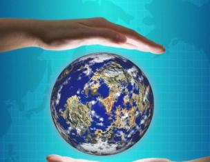
People did not immediately learn that our planet has a spherical shape. Let's smoothly move back to ancient, ancient times, when people believed that the Earth was flat, and let's try, together with ancient thinkers, philosophers and travelers, to come to the idea of the sphericity of the Earth, and with the help of our experiments we will prove the sphericity of the Earth.
Target: prove that the Earth is not flat, but has the shape of a ball
Tasks:
1.Collect evidence of the sphericity of the Earth.
2. Find out the true shape of the Earth.
3. Conduct experiments (experiments) in favor of the sphericity of the Earth.
4.Draw a conclusion based on the research results.
Object of study: the planet we live on, planet Earth.
Methods:
1. Analysis of literary sources.
2. Comparative - descriptive.
3. Experiments.
Equipment: device for demonstrating centrifugal force, funnel, glass vessel for water, tellurium model, camera.
1. Introduction.
Every person knows that the planet on which we live is spherical. The earth is a ball. Is it really?
Different peoples did not develop a correct idea of the Earth and its shape immediately and not at the same time. However, where exactly, when, and among which people it was most correct is difficult to establish. Very few reliable ancient documents and material monuments have been preserved about this.
2. Main part.
1. How the ancients imagined the Earth
In Rus', they believed that the Earth was flat and supported by three whales that floated across the vast ocean.
The ancient Greeks imagined the Earth as a convex disk. The land is washed on all sides by the Ocean River. A copper firmament stretches above the Earth, along which the Sun moves.
The Egyptians believed that the Earth is a lying god, from whose body trees and flowers grow, and the sky is a bending goddess, the stars are the jewels on her dress.
The ancient Indians believed that the Earth was a hemisphere held by four elephants standing on a huge turtle.
2. Evidence of the sphericity of the Earth by scientists
The great mathematician Pythagoras 580 - 500 BC. He was the first to suggest that the Earth is round and has the shape of a ball.
Ancient Greek mathematician, astronomer and geographer Eratosthenes of Cyrene
(about 276-194 BC) determined with amazing accuracy the dimensions of the globe, thereby proving that the Earth is spherical. Eratosthenes' contribution was to measure the length of the earth's meridian. Summary We know this work from Cleomedes’ treatise “On the Rotation of the Firmament.”
Aristotle 384 - 322 BC. He confirmed the spherical shape of the Earth, in the center of which the Earth is located and the Sun and planets revolve around it.
It took a lot of courage for Aristotle. He observed lunar eclipses more than once and realized that the huge shadow covering the Moon is the shadow of the Earth, which our planet casts when it finds itself between the Sun and the Moon. Aristotle drew attention to one oddity: no matter how many times and at what time he observed moon eclipse, the Earth's shadow is always round. But only one figure has a always round shadow - the ball.
Aristotle provided further evidence of the sphericity of the Earth. When you stand on the shore of the ocean or sea and watch a ship going beyond the horizon. Notice that first the hull of the ship disappears over the horizon, then gradually the sails and masts. If the Earth were flat, we would see the entire ship until it became a dot and then disappeared into the distance.
As you go up, your horizons increase. On a flat surface, a person sees around him for 4 km, at an altitude of 20 m already 16 km, from a height of 100 m his horizons expand to 36 km. At an altitude of 327 km, one can observe a space with a diameter of 4000 km.
Climbing to high places (they can even be the roofs of houses), you will notice that the horizon seems to expand. The expansion of the horizon is one of the proofs of the convexity of the earth's surface: if the Earth were flat, this would not be observed.
Nicolaus Copernicus 1473 -1543 also contributed to the proof of the sphericity of the Earth. He placed the Sun at the center of the solar system and made the Earth revolve around it.
He also established that moving south, travelers see that in the southern side of the sky the stars rise above the horizon in proportion to the distance traveled, and new stars appear above the Earth that were not visible before. And in the northern side of the sky, on the contrary, the stars descend down to the horizon and then completely disappear behind it.
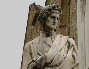
Galileo Galilei 1548 - 1600
« But still she spins!» — catchphrase, which was allegedly said in 1633 by the famous astronomer, philosopher and physicist Galileo Galilei, being forced to renounce before the Inquisition his belief that the Earth revolves around the Sun, and not vice versa.
“But still she spins!” - Let's say, we are at the beginning of the 21st century, meaning any star in the universe. There are no stars in the vast expanses of outer space that do not rotate around their axis. No and never was! What are we talking about? About the stars and the Sun. Modern observations have proven that the emerging cloud of interstellar gas and dust, the protostar itself, rotates. Compressed under the influence of gravity, the matter inside the protostar continues its rotation around its axis passing through the center of mass of the future star. A decrease in the volume of the protostar with the resulting increase in the rotation frequency of the cloud. According to Newton's law, if a force acts on a body, it moves with acceleration. Exactly gravitational force compression of the protostar leads to an ever greater increase in the rotation frequency of the matter that makes up this cloud!
Gradually, ideas about the Earth began to be based not on a speculative interpretation of individual phenomena, but on precise calculations and measurements. The equatorial radius of the Earth is 6378 km, the polar radius is 6357 km. The difference is 20 kilometers. It turns out that the Earth is not actually a sphere, but a sphere flattened at the poles. This is all explained by the movement of the Earth around its axis.
Two important consequences for the processes occurring on it follow from the sphericity of the earth.
The spherical shape of the earth determines the angle at which the sun's rays fall on the earth's surface, and therefore the amount of energy they bring.
3. Evidence of the sphericity of the Earth by scientists and travelers
Travel around the world begins in the first half of the 16th century. The first of them was accomplished (1519-22) by Magellan; more precisely, he commanded the expedition that made the first known trip around the world. Magellan was killed on the way.
After him many made round the world travel. Relatively recently, in June 2005, Russian traveler Fyodor Konyukhov completed a solo circumnavigation of the world in 189 days.
4. Our experiments
Proof one (experience No. 1)
Tellurium (Sun-Earth-Moon Model)
"Movement of Celestial Bodies"
When this device rotates, the sphericity of the Earth and its rotation around the Sun are clearly visible. You can observe the illumination of the planet and the changes
seasons.
The daily rotation of the Earth is the rotation of the Earth around its axis with a period of one day. The Earth makes a full revolution in 23 hours 57 minutes 6 seconds.
From our side - on Earth - we observe the movement of the sky, the Sun, planets and stars. The sky rotates from east to west, so the Sun and planets rise in the east and set in the west. The main celestial body for us, of course, is the Sun. The rotation of the Earth around its axis causes the Sun to rise above the horizon every day and sink below it every night. Actually, this is the reason that day and night follow each other. The Moon is also of great importance for our planet. The Moon shines with light reflected from the Sun, so the change of day and night cannot depend on it, however, the Moon is a very massive celestial object, so it is capable of attracting the liquid shell of the Earth - the hydrosphere, slightly deforming it. By cosmic standards, this attraction is insignificant, but by our standards it is quite noticeable.
Twice a day we observe the high tide and twice a day the low tide. Tides are observed on the part of the planet above which the Moon is located, as well as on the opposite side from it. The Moon makes a full revolution around the Earth in a month (hence the name of the partial moon in the sky), during the same time it makes a full revolution around its axis, so we always see only one side of the Moon. Who knows, if the Moon rotated in our sky, perhaps people would have guessed about the rotation of their planet much earlier.
Conclusions: the rotation of the Earth around its axis leads to the change of day and night, the occurrence of ebbs and flows.
Proof two (experience No. 2)
We took a device that demonstrates centrifugal force. When this device rotates, the cylinders located in the center will move towards the edge of the rod due to the occurrence of this force.
The rotation of the Earth on its axis causes it to flatten at the poles so that all points on the equator are 21 km further from the center than at the poles.
The study of the shape of the Earth showed that the Earth is compressed not only along the axis of rotation.
It has hills, mountain ranges, valleys, depressions of seas and oceans. Therefore, scientists take the ocean level as the earth's surface. The same level of the oceans can be mentally extended to the continents if we cut through all the continents with such deep channels that all the oceans and seas would be connected to each other. The level in these channels was taken to be the Earth's surface. This true form of the Earth was called GEOID (geo-Earth, id-shape).
Conclusion: As the Earth rotates, matter is flattened at the poles. And the faster the device rotates, the faster the displacement of the cylinders occurs, which means the faster the flattening of the spherical body occurs, and the bodies in the neighborhood are repelled.
Proof three (experience No. 3)
We did this experiment in the room in the evening. On the night of the eclipse we observed the Moon. We saw the shadow of the Earth falling on the Moon. They took the ball and the lamp.
The ball represents the Moon, the head represents the Earth, and the lamp placed at a distance represents the Sun. Holding the ball in an outstretched hand, moving it around us, we saw how the illuminated part of the ball was visible to us. The Moon will also be visible from the Earth around which the Moon revolves. Stars in the night sky located in the southern hemisphere are not visible in the northern hemisphere.
Proof four(experience No. 4)
First, mix alcohol with water so that the density of the mixture is equal to the density of vegetable oil. Mixture ratio: 25 ml alcohol, 10 ml water.
Pour the mixture into a vessel and drop the oil, the drop turns into a ball. Conditions of weightlessness have been created for the ball. We carefully rotate the liquid and see how the ball flattens.
The oblateness of the Earth at the poles. The oblateness of the Earth at the poles is caused by centrifugal force, which occurs only as a result of rotation.
The change of night and day.
Conclusion: The oblateness of the Earth is a consequence of its rotation.
Proof five (experience No. 5)
We conducted an experiment that proves that planet Earth rotates around its axis and has two magnetic fields. In our photo we see that the water flows clockwise, since we are in the northern hemisphere. In the southern hemisphere, water will flow counterclockwise. At the equator, the water will not rotate when draining.
All bodies moving horizontally are deflected to the right in the northern hemisphere, and to the left in the southern hemisphere relative to the observer looking in the direction of movement. The deflecting force of the Earth's rotation manifests itself in many processes: it changes the direction of air masses and sea currents as they move. For this reason, the right banks of rivers in the northern hemisphere of the Earth and the left banks in the southern hemisphere are being washed away.
The earth rotates from west to east, so a force arises that deflects all bodies, and therefore water.
Proof six (experiment No. 6)
The Star Hall, which seats 450 spectators, is equipped with a domed screen and a large Planetarium apparatus, manufactured in the GDR. The device contains 99 projectors, with which you can simultaneously see more than 6 thousand stars and planets.
The projection apparatus has a variety of technical capabilities. With its help, you can observe the movement of the sky, the view of the starry sky from any point on Earth at different times, as well as such natural phenomena as sunrise and sunset, aurora, flights of comets and meteors. Ability to simulate flights outer space allows viewers to watch starry sky from the surface of the Moon or any planet, for example, to be near Jupiter, or to see the Solar system from the side. Using a special device, a zoom lens, viewers can also observe constellations with varying degrees of approximation.
A Foucault pendulum is a massive load suspended on a wire or thread, the upper end of which is strengthened (for example, using a universal joint) so that it allows the pendulum to swing in any vertical plane. An observer located on the Earth and rotating with it will see that the plane of the pendulum's swing is slowly rotating relative to the Earth's surface in the direction opposite to the direction of the Earth's rotation
This confirms the fact of the daily rotation of the Earth. At the North or South Pole, the swing plane of the Foucault pendulum will rotate 360° per sidereal day.
3. Conclusion.
Conclusion on the project.
Proof sphericity is based on the statement that all celestial bodies of our solar system have a spherical shape and the Earth in this case is no exception.
A photo evidence sphericity became possible after the launch of the first satellites, which took photographs of the Earth from all sides. And, of course, the first person to see the entire Earth was Yuri Alekseevich Gagarin
04/12/1961.
“Having flown around the Earth in a satellite ship,
I saw how beautiful our planet is.
People, let us preserve and increase this beauty, and not destroy it.”
And in conclusion I would like to say: “Let there be peace on the entire planet!”
List of references and used sources of information
1. Miracles from all over the world. M., Ed. "Enlightenment", 1995, 224 s
2. Bezrukov A.M. Entertaining geography - M.: Bustard, 2005 - 320 s
4. Bychkov A. V. Project method in modern school. - M., 2000.
5.V.Krylova “ Project activities students in geography” “Geography” Supplement to September 1 No. 22, 2007
6.. Pavlova N.O. “Research activities of secondary school students” Festival “Open Lesson” 2006/2007
Cheburkov Dmitry Fedorovich,
Geography teacher MBOU "School No. 106", Nizhny Novgorod
Project with 6th grade students on the topic “Atmosphere”
Creation of an analytical brochure “Recommendations for weather-dependent people to adapt to the weather and climatic conditions of N. Novgorod”
Stages of project activities.
1. Problem situation,
2. Problem
3. Purpose
4. Expected product with evaluation criteria,
5. Planning,
6. Implementation,
9. Assessment of activities in the project.
They are trying to derive the problem from the proposed situation: “How to adapt to weather changes using data on the state of the atmosphere.”2. Definition of the project product
Discusses with students what should help in solving this problem: the Internet, notebooks, rulers, pencils (2 colors), pens.
As a result of the discussion, they determine what the project product should be: recommendations for adaptation for the population to weather changes based on a weather diary, graphic materials on it and a sociological survey.
3. Purpose
Create an analytical brochure “Recommendations for weather-dependent people to adapt to the weather and climatic conditions of Nizhny Novgorod.”
4. Expected product with evaluation criteria
Searching for weather data on a websiteGismeteo. ru.
Graphs of temperature and atmospheric pressure.
Conclusions about their relationships,
Construction of a wind rose for N. Novgorod.
Preparation of a questionnaire on the topic “Weather and our health.”
Processing of materials from the opinion poll “Weather and our health”
They suggest ways to create a product, including:
1) graph of temperature progression;
2) graph of atmospheric pressure;
3) registration of precipitation and cloudiness;
4) identifying the relationships between air temperature, atmospheric pressure, precipitation and wind;
5) construction of a wind rose for N. Novgorod.
6) a survey of relatives and friends on the topic “Weather and our health.”
5. Planning
Planning activities in the project.
Together with the students, he draws up a work plan:
1)preparation of equipment,
2)work on a weather diary (search for data on the websiteGismeteo. ru),
3) drawing graphs (determining the scale of graphs, drawing axes, determining points by coordinates of graphs, drawing graphs),
4)analysis of graphs ( mutual influence air temperature, atmospheric pressure, precipitation),
5) identifying the relationships between air temperature, atmospheric pressure, precipitation and wind;
6) Construction of a wind rose (graph scale, drawing axes, points on the graph, drawing a wind rose, conclusions);
7) sociological survey (determining the composition of the questionnaire: age, the influence of weather on the cardiovascular system, nervous system and musculoskeletal system, and the degree of this influence)
8) Processing the questionnaire (data compilation, drawing diagrams for each question, conclusions).
Invites students to develop criteria for evaluating the final product.
Together with the teacher, they draw up and adjust the work plan. Divided into functional groups, each of which performs a separate segment of work.
1) making a weather diary;
2) plotting the temperature progression;
3) plotting the course of atmospheric pressure;
4) registration of precipitation and cloudiness;
5) a survey of relatives and friends on the topic “Weather and health.”
Select criteria for evaluating the final product:
Accuracy,
Visibility,
Completeness of data
The truth of the data
Timely execution.
6. Implementation
Carrying out group project work.
Monitors the implementation of the plan point by point.
Carry out work in accordance with the points of the plan.
Group 1: temperature graph and conclusions to it.
Group 2: graph of atmospheric pressure and conclusions to it.
Group 3: wind rose and conclusions to it.
Group 4: processing of survey materials.
7. Product evaluation based on criteria
Determination of criteria for evaluating the project product.
Grade
8. Conclusion about the degree of goal achievement
Invites students to start drawing graphs.
Discusses the survey results with students.
Build graphs of temperature and atm. pressure.
Process the survey results.
9. Conclusion about the degree of achievement of the goal
Reflective-evaluative stage.
A conversation about the relationship between atmospheric pressure and wind. Analysis of the constructed graphs. Joint development of recommendations for rational adaptation to the weather and climatic conditions of the Nizhny Novgorod region.
10. Assessment of activities in the project.
Invites students to develop criteria for evaluating their own work and conduct reflection.
They reflect on their activities at each stage of the project, according to the evaluation criteria.
conclusions
During the work on the project, we performed the following actions:
Data on the state of the atmosphere over Nizhny Novgorod was collected. (on sitegismeteo.ru);
Weather diary analyzed;
A graph of temperature progression was constructed;
A graph of the course of atmospheric pressure was constructed;
The compass rose has been built;
A sociological survey was conducted on the topic “The influence of weather on your health.”
We found that the climate of N. Novgorod is characterized by significant differences in temperature and atmospheric pressure, but does not create significant obstacles to people’s economic activities.
Almost half of the survey participants noted the absence of a relationship between the weather and well-being. 57% of respondents indicated that they have some degree of weather dependence.
The following recommendations have been developed for weather-sensitive citizens:
Monitoring the meteorological situation in the city using weather forecasts;
Identifying the relationship between atmospheric pressure, temperature and your own health;
Taking medications in advance to reduce the negative effects of weather changes;
Rejection of bad habits;
Physical activity appropriate to age and health status;
Preventive examination in hospitals.
Application. Table of criteria for assessing students’ project activities at the reflective-evaluative stage
Group _____________________ Evaluation criteria
0 – the criterion is not presented, 1 – the criterion is partially presented, 2 – the criterion is fully presented.Presentation: Geography lesson in 6th grade Lesson topic: “Geographic coordinates”
Geography lesson in 6th grade Lesson topic: “Geographic coordinates” Purpose of the lesson: To form the concepts: “ geographic latitude", "geographical longitude"; learn to define geographical coordinates. Stages of the lesson Teacher's introductory speech: Introductory...
Presentation: ATMOSPHERE, its structure and meaning lesson on physical geography 6th grade 6th grade (textbook by Gerasimova T.P.)
ATMOSPHERE, its structure and significance lesson on physical geography 6th grade 6th grade (textbook by Gerasimova T.P.) Lesson objectives 1. Educational: to form the concept of the atmosphere as the outer gaseous shell of the Earth. form a concept of atmosphere as...
Presentation: Library of electronic visual aids “Geography 6-10th grade” Switches auditory perception of information to visual, which raises it to a new level.
Library of electronic visual aids “Geography 6-10th grade” Switches the auditory perception of information to the visual, which raises its quality to a new level. Switches the auditory perception of information to visual, which raises it to a new level...
Presentation: Groundwater Geography lesson in 6th grade. Author: Nina Valentinovna Karezina, geography teacher, Secondary School No. 5 in the city of Svetly, Kaliningrad region.
Groundwater Geography lesson in 6th grade. Author: Nina Valentinovna Karezina, geography teacher, Municipal Educational Institution Secondary School 5 in the city of Svetly, Kaliningrad Region Municipal Educational Institution Secondary School 5 in the city of Svetly, Kaliningrad Region HydrosphereHydrosphere Waters of the World Ocean Seas Bays...
Presentation: Groundwater and reservoirs Performed by students 6 “B” of the Municipal Educational Institution Gymnasium 25 in Stavropol: Maria Mikhaleva, Anastasia Belyaeva. Geography teacher Berezyuk checked it.
Underground waters and reservoirs Performed by students of 6 “B” Municipal Educational Institution Gymnasium 25 in Stavropol: Maria Mikhaleva, Anastasia Belyaeva. Checked by geography teacher Berezyuk E. G. Reservoirs Modern geography of continents and islands is difficult to imagine without...
Geography lesson - 6th grade. Author: Karezina Nina Valentinovna, geography teacher, Secondary School No. 5, city of Svetly, Kaliningrad region.
Geography lesson - 6th grade. Author: Karezina Nina Valentinovna, geography teacher, Municipal Educational Institution Secondary School 5, city of Svetly, Kaliningrad Region Plan for studying the lesson topic: 1. Interrelation of organisms 2. Natural complex 3. Geographical envelope and biosphere Natural...
Developmental exercises in geography lessons, grade 6 Teacher, MAOU Secondary School 13, Chelyabinsk Ivleva M.I.
Developmental exercises in geography lessons, grade 6 Teacher, MAOU Secondary School 13, Chelyabinsk Ivleva M.I. KRU complex, ensuring the arbitrariness of mental processes, the formation of educational actions (using the example of the topic “Lithosphere”) Type of exercise: Correction...
Municipal educational institution "Basic secondary school 3" "Scale of the plan" (geography lesson 6th grade) Teacher: T.F. Eremeeva.
Municipal educational institution "Basic secondary school 3" "Scale of the plan" (geography lesson 6th grade) Teacher: T.F. Eremeeva What will we do in class? Let's get acquainted with the concept of “scale”; Let's find out: What is scale needed for? What does the scale show? What types of scale...
Folk signs of the weather Municipal educational institution Ilyinskaya basic secondary school, Vengerovsky district, Novosibirsk region.
Folk signs of the weather Municipal educational institution Ilyinskaya basic secondary school Vengerovsky district of the Novosibirsk region Petrova Irina 6th grade Leader Ionycheva Galina Stepanovna geography teacher 1st category The purpose of the work...
This project relates to the subject areas: GEOGRAPHY and ECOLOGY. This project relates to the subject areas: GEOGRAPHY and ECOLOGY. Project participants.
This project relates to the subject areas: GEOGRAPHY and ECOLOGY. This project relates to the subject areas: GEOGRAPHY and ECOLOGY. The project participants are students in grades 6-9 aged 12 to 15 years. Project participants are students 6-...
Geography lesson 6th grade Compiled by geography teacher MS(k)OU “S(k)OSH 24” Solomina I.I.
Geography lesson 6th grade Compiled by geography teacher MS(k)OU “S(k)OSH 24” Solomina I.I. Review on the topic: “Ocean Currents” 1. What are the differences between ocean currents and the movement of water during waves? Answer: The ocean current has a constant...
Name of the researcher work on geography of the student(s) of the 6th grade Last name Municipal educational institution secondary school 32 “Associated school of UNESCO “Eureka-development”
Name of the researcher work on geography of a 6th grade student Last name Municipal Educational Institution Secondary School 32 “Associated School of UNESCO “Eureka Development” Portrait of the researcher, brief biographical information about him The most important expeditions, their goals, who organized them, who participated in them...
Diamonds Presentation on geography by Gneusheva Nadya, student of 6th grade “A” of State Educational Institution Secondary School 1257 in Moscow.
Diamonds Presentation on geography by a student of grade 6 “A” of the State Educational Institution Secondary School 1257 in Moscow by Gneusheva Nadya Diamond is a mineral, one of the allotropic forms of carbon. The main distinguishing features of diamond are the highest hardness among minerals, the highest thermal conductivity among...
“Environmental monitoring of the school site” Non-state private educational institution “Center for Individual Training and Development” Project.
“Environmental monitoring of a school site” Non-state private educational institution “Center for Individual Training and Development” The project was completed by: 5th and 6th grade students Project leaders: geography teacher Tatyana Borisovna Kovina teacher...
MBOU SSH12 resort town of Anapa Lesson - game “Experts - Geography”. 6th grade Prepared by: geography teacher Lidiya Mikhailovna Kochanovich.
MBOU SSH12 resort town of Anapa Lesson - game “Experts - Geography”. 6th grade Prepared by: geography teacher Lidia Mikhailovna Kochanovich Goals of the game: Development of cognitive and creativity students. Developing the ability to work in a group. Expansion and...
Explanatory note
Studying geography in a correctional school for children with intellectual disabilities has important educational, practical and educational significance. Formation cognitive activity in geography and the development of independence occurs in close relationship, is mandatory integral part process of training, education and development of students with intellectual disabilities.
A correctional school must prepare its graduates for life, for correct behavior in nature, life among people, and for achieving success at work. The question “How to teach?” children correctional school is especially relevant at the present time, since every person, including those with developmental disabilities, has the right to occupy a worthy niche in life.
Modern education should instill in students the ability to set a goal at the beginning of their activities, look for ways to achieve it, and achieve success. Solving this problem is impossible without using a variety of forms in the lesson, which involve active work students with developmental disabilities during the lesson. It seems that this task is most fully realized by involving the student in independent work. But fruitful independent work is possible only after a developed interest in the subject.
By the ninth grade, students’ cognitive activity should be at a sufficiently high level. It is very important to instill independent work skills not only for the purpose of knowledge, but also to form independence as a personality trait.
Geography as an academic subject in special (correctional) school VIII looks like great importance for the comprehensive development of students with reduced motivation for learning. Studying geography broadens students' horizons about the world around them, allows them to see natural phenomena and social economic processes in relationship. Geography provides fertile material for the patriotic, international, environmental education of students, and helps introduce them to professions that are common in their region.
Workbooks in grades 6–9 help to carry out independent practical work. But work with them is of an individual, differentiated nature, so this work has a goal: to study the potential capabilities of students with developmental disabilities when performing independent work.
Teaching geography presupposes and requires studying the material of one’s locality. The ninth grade geography course ends with a regional overview. The fourth quarter of ninth grade is devoted to studying the Kostroma region. In these lessons, students should systematize their knowledge about the nature of the Kostroma region, their region, and become familiar with local economic problems.
Tasks:
1. Develop a system of measures to prevent difficulties for students when performing independent work.
2. Prepare didactic material to check the quality of knowledge of students in geography of the 6th grade of a special (correctional) school of the VIII type.
3. Develop a workbook for the Kostroma region for grade 9.
Theoretical part
(from work experience)
Students of the VIII type correctional school are children with intellectual disabilities whose intellectual development is impaired due to organic brain damage.
Intellectual disability is a general concept that denotes the main defect of children who are subject to education in a correctional school. Among the students of the VIII type correctional school, there are children with varying degrees of intellectual disability, which occurs at later stages of the child’s development due to illness, i.e. inflammation of the brain and its membranes.
As a result of brain inflammation suffered by a child, mental disorders can occur.
Among the students there are also children who have suffered a traumatic brain injury, which also causes mental changes in children.
Students with developmental disabilities differ significantly from their peers in the nature of cognitive activity, and in the characteristics of behavior in a team, in their ability to work and in other personality qualities. It is important for a teacher to know these features in order to shape the cognitive activity of students.
Among the students there are also children whose intellectual disability is due to the current disease process. These are children - epileptics and children - schizophrenics.
The fact that intellectual disability in a child can be caused by various reasons, including different time his life, obliges us to deeply study each student, take into account the characteristics of the defect of intellectual disability in the learning process, and gradually form the cognitive activity of children with developmental disabilities.
Defects in the development of the cognitive sphere in schoolchildren with intellectual disabilities are varied. But all of them have a pronounced underdevelopment of the emotional-volitional sphere.
The level of speech underdevelopment in most children with intellectual disabilities corresponds to the degree of their intellectual defect. They are characterized by a delay in the development of speech; deviations from the norm occur when mastering difficult words in geography. The sentences children use are often constructed primitively at the everyday level. They often deviate from language norms. Students' answers may be too concise or, conversely, lengthy. Even high school students experience difficulties in cases where they need to talk about the progress of practical work.
By high school, the vocabulary is significantly enriched. Deviations are found in all manifestations of schoolchildren with intellectual disabilities, but this is especially manifested in cognitive activity, in their thinking.
Thinking is a generalized reflection outside world, a socially determined process of cognition. Schoolchildren with intellectual disabilities have limitations at all levels of mental activity. The greatest difficulty is caused by tasks in geography that require verbal - logical thinking, such as understanding tests containing certain dependencies - temporary, causal, etc.
As students learn, their deficiencies are corrected, but not overcome. The thinking processes of children with intellectual disabilities are inhibited. The mental analysis they perform of a visually perceived object is characterized by poverty and fragmentation.
When looking at herbariums, students do not name the main thing, but distinguish what easily catches the eye. Unsystematicity and disorder are revealed.
Gradually, students can master the ability to characterize an object. Progress manifests itself in an increasing ability to use one's own experience. Gradually, children with intellectual disabilities compare two or more objects and find it difficult to find similarities or differences between objects or phenomena, and in some cases, to identify their identity.
A more difficult task for students with intellectual disabilities is generalizing subjects.
Teaching children with intellectual disabilities is based on memory processes, which has its own characteristics. The volume of memorized material in schoolchildren with intellectual disabilities is less than that of their typically developing peers. The accuracy and strength of verbal and visual material is low. When reproducing it, students often repeat themselves and pronounce missing elements.
Memorizing texts also suffers from imperfections, because... divide it into parts, highlight the main idea, define reference words, establish meaningful connections. As a result, children retain only part of the material in their memory.
High school students remember material more easily when they read it aloud. It follows that in geography lessons it is important to pay attention to working with the textbook.
A characteristic feature of a correctional school student of type 8 is a violation of the volitional sphere; the formation of the cognitive sphere in children with developmental disabilities is difficult precisely because the volitional sphere in children with developmental disabilities is defective.
Their perception is specific. Children find it difficult to draw a verbal color picture. Conditions that help improve perception include showing an object, using various techniques - using stimulating cues and a system of questions that direct attention and encourage the performance of certain actions.
Spatial orientation in schoolchildren with intellectual disabilities is very poorly developed.
The study of the psychological and pedagogical characteristics of schoolchildren with intellectual disabilities and their capabilities (M.F. Gnezdilov, G.M. Dulnev, L.V. Zankov, M.S. Povzner, I.V. Solovyov and others) made it possible to develop principles of work in correctional school. Based on the teachings of L.S. Vygotsky about the leading role of education in the development of children, it was established that the work should be carried out through the use of special pedagogical techniques that will gradually contribute to the formation of their cognitive activity in schoolchildren with intellectual disabilities.
Geography lessons from grades 6 to 9 are based on natural history. It would seem why students at a special correctional school need geography. However, having delved into the content of this subject, we can conclude that, although the material is presented in a simplified form, it has great independent, educational and correctional educational significance.
The program is built taking into account the principle of science and is not primitive at all. Observations in nature primary school, in natural history in 5th grade are the initial basis for studying geography. The scope of knowledge is provided taking into account the capabilities of students with developmental disabilities.
The initial course of physical geography in grade 6 introduces students to their immediate environment. Terrain orientation serves as the basis for studying the terrain plan, and also contributes to the formation of spatial concepts and orientation skills necessary in life. Tasks for independent work will not only help to identify the potential capabilities of students and formulate a goal for further work, but also broaden their horizons.
Studying the topic “Thermal zones on the globe” helps to understand the cause-and-effect relationships and relationships between the location of countries and their nature. In the process of studying this topic, students gain ideas about tropical forests and deserts, about the life of people with hot, cold and temperate climates. The formation of the concept of “climate” is based on students’ long-term observations of the weather.
The 7th grade course is dedicated to Russia. Students will learn what natural zones are: arctic desert zone, tundra zone, forest zone, steppe zone, desert zone, high mountain and subtropical regions. Each nature is studied through a process of comparison.
In grades 8 and 9 – geography of “Continents and Oceans”. These are the World Ocean, Australia, Antarctica, North and South America, Africa and Eurasia. The formation of independent work skills continues. By this time, it is already possible to draw conclusions about the potential capabilities of students in a Type VIII correctional school.
Modern geography lesson
A lesson is the main form of implementation of pedagogical influences, where direct and systematic communication between teacher and students occurs, aimed at activating the cognitive capabilities of schoolchildren. Each lesson is a complex organizational and pedagogical system, all components of which are interconnected and interdependent. On the one hand, a lesson represents a link in a holistic educational process. On the other hand, a lesson is a completed independent fragment of the learning process, by which both the pedagogical and methodological skills of the teacher and the level of preparation of the student are often judged. Therefore, the lesson was and remains unique " business card» teacher, allowing colleagues to judge the methodological style, quality of work, and creative potential of the teacher. A separate lesson in a teacher’s work system is a fragment of a large action, which is entirely directed by the teacher himself. The success of such a “statement” depends on how correctly the goals are defined, the main and additional ones are selected educational material, methods and means of teaching adequate to the content have been identified.
Geography lessons in a correctional school of the VIII type can be diversified (game lessons, travel lessons, workshops and creative works); increasing attention to the integration of knowledge, as well as to conducting integrated lessons (at the stage of generalization and systematization of knowledge) with historians, teachers of reading, art, mathematics, music.
Possible combinations of lesson types:
1. combined
2. learning something new – combined – final survey
3. learning new things in “large blocks”
4. independent and practical work when learning new things - combined - generalization of knowledge (non-standard lesson): travel lesson, business game, etc.
Table 1
Types of lessons Lessons on the formation of new knowledge Lessons on teaching skills Lessons on repetition and generalization of knowledge, consolidation of skills Lessons on testing and taking into account knowledge and skills Combined lessons
Forms of lessons Expedition lessons (travel), research lessons, integrated
lessons. Workshops, practical work, essays, dialogue lessons, lessons with role-playing, business games Lessons extracurricular reading repeating and generalizing lessons, games: KVN, “What? Where? When?”, “Field of Miracles”, “Happy Accident”. Integrated theatrical (lesson-court), lessons-competitions, lessons-competitions Lessons-quiz, lessons-competitions, lessons-essays, etc.
Lesson - practical work.
The specificity of geography as an academic subject lies in the fact that a necessary condition for its mastery is that schoolchildren have the ability to use various sources of geographic information: maps, statistical data, text, etc. These skills can be mastered during performing practical work.
Schoolchildren's problems when performing practical work are primarily related to the fact that they perform many actions unconsciously, on the basis of imitation and copying. All this leads to overload and low performance in the subject. To avoid this, it is advisable to comply with the following requirements:
1. To familiarize schoolchildren with the purpose of carrying out each practical work, possible forms of reflecting its results.
2. Use instructional cards to successfully implement the principles of differentiated learning.
3. Create a creative atmosphere of cooperation, not fetter the initiative of schoolchildren, but offer them different ways achieving the intended goal.
4. Use game elements, creative tasks, original ways recording work results (at the request of schoolchildren).
It is important that the results of the work are assessed objectively. To do this, we recommend the following approximate rating standards:
Types of practical work.
1. By content:
Determination of the object's GP.
Characteristics of the economic sector, etc.
Assessment of the territory’s natural resources, living conditions and human activities.
Explanation of the patterns of distribution of mineral resources, economic sectors, population, the influence of nature on human life and economic activity, etc.
Forecasting the consequences of human activity on nature, etc.
2. By level of independence:
Work in the classroom under the guidance of a teacher.
Work in a group with the help of classmates.
Work in the classroom or at home using instructional cards, reminders, techniques, etc.
Independent work at home, in the classroom or in the field.
3. According to the form of recording the results:
In a notebook in the form of a diagram, table, description.
On contour map.
Filling out a field diary during the excursion.
Construction of a site plan.
4. On organizing student activities:
Individual work at home, in the classroom or in the field.
Group work in class.
5.According to the sources of geographic information used:
Map.
Text.
Painting, drawing,
Diagram, table.
Students with developmental disabilities perform practical work with contour maps according to the program. There are no contour maps specifically for correctional schools. For public schools they can only be partially used.
Labeling the contour map begins in 6th grade. A hot belt is painted red, a moderate belt is painted with green, a cold belt is painted with a simple pencil. In the “Globe” theme, Magellan’s path is drawn with a dotted line. They indicate state borders. For the topic “Overview of Parts of the World,” outline maps help you compare them by size.
Practical lessons on the map are reinforced by orienteering on the map. For example:
- In what direction from Tajikistan is Kyrgyzstan located?
+ Kyrgyzstan is located northeast of Tajikistan.
- In what direction from Ukraine is Moldova located?
+ Moldova is located southwest of Ukraine.
Lessons - excursions
The main criterion in choosing the time should be the didactic purpose for which this excursion is conducted: the accumulation of ideas, the formation of skills, the study of the manifestation of cause-and-effect relationships on specific objects, repetition, etc.
Educational excursions in the sixth grade for schoolchildren are the first geographical excursions. Before going to the area, it is necessary to explain to students the importance of excursions for studying geography, the purpose and objectives of a particular excursion; talk about the location where it will be held and the objects that will be studied; It is advisable to show the route on a schematic plan of the area. Students should also be told what equipment they should take with them, how to dress, etc. To prepare for work on the ground, it is necessary not only to demonstrate, but also to carry out training on mastering the techniques of using instruments and equipment. ¬rumentov (with a level, eclimeter, etc.). Under the guidance of the teacher, students must prepare a field diary in advance: write a plan according to which the object will be studied, and leave space for recording the data obtained about it. Then - introduce them to the techniques of working on the ground. It is advisable to show children, as a sample, already prepared materials from excursions of previous years, which are usually available in the geography classroom.
At this stage, adult teaching assistants (if necessary) are also identified ( classroom teacher or high school students, parents, etc.).
The procedure for the excursion is as follows. Upon arrival at the destination, the teacher reminds the students (or asks as a reminder) the purpose and objectives of the excursion, explains why the students came here, gives appropriate explanations, and indicates the objects that the students should study. There should be no excursions during which the teacher gathers the children around him, names and shows natural objects and considers that the excursion has been completed. There should also be no excursions in which the teacher, overestimating the students’ capabilities, on the very first geographical excursion invites them to complete all the tasks independently. For children, the environment itself, that is, being outside the classroom, is a new condition for work. Therefore, the first excursions in the initial course of physical geography should be primarily educational in nature.
One of the options for organizing student work is to work according to the model shown by the teacher. After preparation in the classroom, the teacher on the ground talks about the object (hill, river, stream, lake, ravine, etc.), shows how to do practical work and checks how much the students understand it (asks two or three students), then reminds which should be recorded in the field diary. Students get to work.
The second option for organizing an excursion assumes that students are well prepared for independent work. This preparation consists of preliminary work by the teacher on site with those students who, during the excursion, act as foremen in groups (the number of student groups can be formed according to the number of objects being studied). The excursion with all students in the class begins with familiarizing them with the area. Then each group goes to its own object (for example, the first - to the source, the second works near the stream, the third - at the slope of the river bank, where it studies the outcrop, etc.). After some time, a change of objects occurs. The teacher only observes the activities of the groups. Corrects, helps.
When organizing the work of students in groups, it is necessary to keep in mind that this is an educational excursion, that students must get acquainted with the intended objects for study and that’s all - do practical work. Therefore, the distribution of groups by objects used by some teachers (one studies, for example, only a river, the other only a ravine) is permissible only on excursions that are conducted with members of a geographical circle. Usually on an excursion, depending on its goals and the number of students, their preparedness is combined frontal forms of work with group ones. At the end of the excursion, the teacher briefly summarizes the results and characterizes the students’ work. It also talks about the progress of further work on the collected material.
Lessons - games.
Application didactic games in the learning process allows you to combine two important types of activity: educational and gaming.
Play activity in the lesson allows you to make the learning process more interesting, attractive for everyone, helps to implement the principles of individualization and differentiation of learning.
Didactic goals The use of games in geography lessons can be different:
1) practicing previously acquired knowledge and skills;
2) application of knowledge and skills in a new situation;
3) deepening and expanding knowledge;
4) education of such personal qualities as the ability to defend one’s point of view; a sense of responsibility for the country's natural resources; a feeling of love for the Motherland and one’s native land.
table 2
Situations in which games can be successfully used
Situations Final result
1. Due to the content of the educational material, theoretical and objectively complex material has practical orientation, it is advisable to “work it out in action”, i.e. in a game situation, local history material.
2. Determined by didactic tasks It is necessary to generalize new material, deepen and practice previously acquired knowledge, apply it in a new learning situation.
3. Associated with increased attention to educational tasks: Fostering a responsible attitude towards nature, nurturing a thrifty, reasonable attitude towards natural resources, the ability to defend one’s opinion.
Game classification:
1. Creative games:
1) role-playing (protection of projects, creation of models)
2) role-playing games (travel games, presentation games, press conferences)
3) competition games
2. Games with rules (didactic):
1) board games
2) outdoor games on the ground
Memo for evaluating the answers of game participants.
The participant in the game who:
1) is actively working;
2) gave a complete and correct answer to all proposed tasks;
3) provided assistance to teammates (group, brigade);
4) gave a complete answer, used it correctly geographical terms and concepts, correctly named and showed geographical objects;
5) made independent decisions in difficult situations;
6) objectively assessed the activities and results of his comrades, as well as his own;
7) used in the answer not only information from the school textbook.
Lessons - tests
There are methods, forms, means and types of control: individual educational survey, frontal and compact survey, geographical games, test control, etc.
Each form of control, having its own advantages, is not universal. The choice of one or another form of control is determined by the goals and objectives of training and education at a given stage, the type of lesson, the specifics of the educational material being tested, the level of preparedness of the class, and the age capabilities of students.
It is the choice and optimal combination of different forms of control that is the most difficult and poorly developed issue in the methodology of teaching geography in a correctional school of the VIII type.
Complex material, large in volume, requiring analysis and generalization of knowledge, involves conducting an individual oral survey in order to attract the class's attention to the key issues of the topic.
The group form of work will be effective in solving problem tasks and conducting tests.
Working with the textbook
The main teaching aid for students, which serves as a source of knowledge, is the textbook. Textbooks on geography and natural history are new, colorful, and quite difficult in content. Taking knowledge from a textbook is not an easy task, but it is the most important task. Questions about the text, illustrations, and maps are at the end of each paragraph. Their task is to make independent work easier and help in studying and repeating material.
The texts of the articles in the textbook are written lesson by lesson, but students should not retell it word by word. There is usually more material provided than is provided by the program. For example, “For the curious” we leave for independent reading, because this material is not mandatory, although it is easy to remember.
I most often conduct students’ reading of an article in a textbook after checking their homework, introductory conversation, and their story. The skill and ability of students to find something new in an article that is not yet familiar, and compare it with what is already known, is obtained only in high school.
The initial reading of a business article, if it is complex, is different than in a public school. There, the geography textbook is intended mainly for independent work. In the 8th grade school, it is not included in independent work. Students with developmental disabilities must read the entire article. And then selectively showing on the map, paintings, described phenomena or objects. All students are included in class reading.
Less complex texts can be read silently, but it is necessary to take notes in notebooks.
This is how knowledge about geographical nomenclature gradually accumulates.
Working on a map
One of the main teaching aids in geography lessons is a map. It is a source of geographical knowledge. If we draw a verbal description from a textbook, then a map is a source of geographical descriptions.
Translated from Latin, “map” means drawing, drawing. Natural phenomena and objects are shown on the map using symbols.
Gradually, schoolchildren will learn to read kata. And by reading the map, you can see the area. A system is definitely needed here as one of the means of cognitive activity. The children remember the colors of the physical map quite well. Understand which surface is indicated on the map in green, brown, yellow. Conventional signs of capitals, cities, and state borders do not cause any difficulties.
When practicing reading maps using conventional colors, I constantly use a globe, which clearly shows the model of the globe.
Using the map, you can compare the size of states and the length of borders. The guys show the way on the map famous travelers, find out their stopping places, name the seas, oceans, straits, islands.
Correspondence travel helps to consolidate conventional signs. Students love these types of assignments. They tell what terrain they will travel through to get to Moscow, how they will get to Egypt or North America.
Students distinguish between a physical map, a map of natural areas, a political map, and a map of the hemispheres, since maps have different purposes. Map work is accessible and interesting to students with developmental disabilities. The greatest difficulty is in representing the true sizes and distances on the map, since their spatial imagination is poorly developed.
And yet the formation of cognitive activity is moving forward. Before the children become familiar with the main directions of the sides of the horizon on the map, they learn to determine them on the globe. Tasks of this type: to show the northern shore of the Black Sea or to determine in which direction from Moscow St. Petersburg is located cause significant difficulties for the students of our school. When checking geographic nomenclature with tasks such as showing something on a map geographical feature or determine the geographical location of an object, not everyone, but they manage.
When studying natural areas, children learn a lot about cause and effect relationships of a geographical nature. The map helps explain:
why irrigation canals are built in desert zones;
why the main occupation in the tundra is reindeer herding;
Why is there a long and cold winter in the tundra?
Students practice using a map to find islands and peninsulas, rivers and lakes, mountains and plateaus, highlands and lowlands. In Europe, Asia, America, Australia.
Thus, working with the map, we activate the cognitive activity of students, correct attention, thinking, and imagination.
Work in notebooks
I consider keeping notebooks on natural history and geography obligatory, as this is of great importance for consolidating the acquired knowledge. The notebook accustoms students to systematic work, fosters independence and self-control.
What do we do in our notebooks?
We make sketches of objects and phenomena that teach us to clearly imagine, peer carefully, and observe. Free drawing is not allowed.
Then the students, using the drawing, tell what they drew.
We draw diagrams, for example, the diagram “Structure of a volcano”, “Water cycle in nature”. This gives students the opportunity to better learn and remember the content of the material.
We make short notes, conclusions, new words. This forms an understanding of the main material.
Filling out the tables.
Forest zone
Plants Animals Birds Fish Mushrooms Flowers Berries
Rivers
Name of the river Where it originates Where it flows
The notebook gives me an idea of the individual characteristics of children. When checking the notebooks, the character traits of the children are clearly visible: instability, stubbornness, crossed out notes and drawings in some, neatness and diligently completed work in others.
Vocabulary work
In geography and natural history lessons, vocabulary work is required. At the end of the textbooks there is a large list of words that are encountered when going through new material. I have all the vocabulary words in folders by grade. In the textbook these words are indicated with a special sign
Corals* - sea animals
Koala* - marsupial bear
etc.
Of course, there is no need to memorize all the words, but you can’t do without dictionary words from a cognitive standpoint.
I place the words on a magnetic board. Some of them are difficult to pronounce, so I additionally post them with a division into syllables in a difficult place, for example: At – Atlantic. Ant – arctic. We read such words in chorus, stopping after the first syllable, then individually.
Vocabulary words are posted while studying the topic or while reviewing the relevant topic.
Vocabulary work in geography and natural history, as well as in writing, requires a system. Each year provides a certain amount of knowledge. The influx of these words is not accidental, but corresponds to the program. Let's get acquainted with the words different stages lesson, depending on the difficulty and meaning of the word, but most often before reading the article in the textbook. It is also possible to write the word in a notebook while reading.
Use of TSO and ICT
Now science has made great strides forward, and it is now possible to show films in class. A large film library has been created in the office on almost all topics in the geography of “Continents and Oceans” for grades 8 and 9, and the geography of Russia for grade 7.
I am very careful about showing films. When selecting a film, I always take into account the psychological characteristics of children with developmental disabilities. Under no circumstances should you include the entire film, as some episodes will not be understood by students. I show only small fragments, guided by the curriculum. Sometimes I don’t turn on the sound, I tell the story myself, since the speaker’s verbal accompaniment can be verbose and incomprehensible for children with developmental disabilities. Students will understand more short phrases, pronounced synchronously with visual material.
The guys remember many moments from the film themselves without much comment. But they remember not the main thing, but the secondary, emotionally rich stuff.
While showing the film, I direct the children’s attention to the main thing, which is necessary in a cognitive sense. If the announcer speaks, I first explain difficult words and expressions. Sometimes I give questions on a piece of paper, warning that they will need to be answered after watching the film. When checking homework I show a still from the film again if it has educational value. After watching the film, I make sure to consolidate the information received, since it is difficult for children with developmental disabilities to grasp and remember what they saw on the screen. Any educational film requires discussion, otherwise it loses its significance.
I never warn before a lesson that a still from a film will be shown, because, having learned about it, the children will be in anticipation, and the explanation may go down the drain.
Checking and assessing the quality of schoolchildren’s training
In the process of teaching geography in a type VIII correctional school, certain requirements are imposed on knowledge and skills by year of study. There are somewhat reduced requirements for the knowledge and skills of students with severe complications. There are very few such children, but they are always present in the class.
It is important that the results of the work are assessed objectively. To do this, we recommend the following approximate rating standards:
“5” - answers are given correctly in terms of content, there are no errors in formatting;
“4” - errors in design, minor defects in content;
“3” - errors in revealing the essence of the issue, inaccuracy in measurements, negligence in design;
“2” - serious errors in content, lack of design skills;
“1” - complete lack of knowledge and skills necessary to complete the work, gross errors in content, lack of understanding of the essence of the task.
Reducing the level of requirements is carried out for the most difficult topics of the program in the geography course. In the 6th grade, such topics are “Orientation on the ground”, “Plan and map”.
Instead of drawing plans and determining the scale, such students can give answers based on ready-made plans, drawings made by other students or the teacher.
In the 7th grade, when studying the map of Russia and the nature of our Motherland, some restrictions can also be made in assessing the knowledge of students with sharply reduced intelligence, memory and spatial orientation. So, when working with wall and table maps, the teacher can help such students find the location of objects and help the student read the name. In such cases, the student should take into account the names on the map not mechanically, but with a specific representation of the area, the object that he names. For this, it is especially important for weak students, at the same time as showing them on the map, to let them see the image of these objects in a painting, postcard, etc.
On topics related to the study of natural conditions in Russia, the main
When interviewing students, attention should be paid to their assimilation of knowledge about economic use natural resources, about people’s work and to cultivate a caring attitude towards our native nature.
Independent and testing work with a contour map (mapping the objects being studied, performing geographical dictations) are given to all students in the class. At the same time, students with a sharply reduced level mental development You may be allowed to use table maps or atlases.
The teacher must know the level of knowledge and skills of the students, in accordance with which it is necessary to prepare tasks that will promote the advancement and development of mentally retarded students in mastering the material in this subject.
Teaching geography involves applying large quantity tasks for independent work, which helps to more successfully implement the correctional capabilities of the subject.
Methodological part
As practice shows, applying knowledge of geography when performing independent work causes difficulties for students with developmental disabilities. Hence, there was a need to explore the potential capabilities of students in their independent work.
The object of research in this experiment was the independent work of students in grades 6–9 of a special (correctional) school of the 8th type in the city of Buya, Kostroma region, in which children from the city of Buya, Kostroma and Buysky districts, and the city of Kostroma study. Children have a diagnosis mental retardation. Some of them have disturbances in the emotional and volitional sphere.
52% of students live in rural areas. 73% live in low-income families, 38% in single-parent families.
In pedagogical practice, geography teachers at grade 8 schools encounter certain difficulties in organizing independent work in a geography lesson, on the one hand, and a lack of desire for independent activity among students, on the other hand.
The idea of the experiment was the assumption that independent work - the most important means correction of developmental deficiencies. However, when performing independent work, students, due to the characteristics of cognitive activity, experience certain difficulties, therefore special pedagogical work on organizing independent educational activities.
A practical solution to this idea was the development of a workbook on the geography of the Kostroma region for students in grade 9 (Appendix 2) and didactic material for grade 6 (Appendix 1), which can be used in lessons, as well as as a repetition in general lessons.
When doing independent work, students perform exercises based on a map and plan, make schematic sketches, and observe the weather. These types of activities are difficult for students with developmental disabilities. They are unable to comprehend the task at hand and outline a plan of action, since they cannot subordinate their actions to the set goal. They also find it difficult to apply the acquired knowledge and skills related to spatial orientation.
When doing independent work, students encounter difficulties in analysis, since when covering topics in geography, children more often remember secondary, emotionally rich things, rather than the main thing. Disadvantages of analysis negatively affect the process of comparing objects, as well as the nature of representations.
A particular difficulty for students with developmental disabilities is understanding cause and effect relationships and phenomena of the surrounding reality. These relationships are much better understood not from the words of the teacher, but as a result of practical, effective familiarization with the various transformations of objects under the influence of certain external influences (T.I. Golovina
To find out the possibilities of independently completing work, a series of experiments was conducted with students from grades 6 to 9. Methods of increasing and decreasing teacher assistance and free choice of tasks were used. Experiments show that students can be divided into four groups according to the level of independent completion of work in geography.
The first group consists of students who have a high level of independent work performance. Such students cope with tasks of a searching and creative nature. They show interest in doing independent work, although some of them also need stimulating actions from the teacher. There are 25% of such students.
The second group consists of students who are characterized by an average level of independent completion of tasks. These students need the guidance of a teacher when performing independent work. Such students can perform simple search tasks, but find it difficult to complete creative tasks. Such students make up about 51%.
The third group consists of students who are characterized by a low level of independent completion of educational assignments in geography. These students require significant assistance in completing independent work. Constant failures in independent work form a negative attitude towards it. This group includes students with a severe impairment of purposeful activity. They make up about 24%.
The fourth group are students who cannot cope with independent work in geography at all due to low intellectual development.
Experimental data indicate that with independent tasks 87% of students in the class fail, 86.5% in 7th grade, 86% in 8th grade. The students of the second group, who needed the help of the teacher, encountered significant difficulties. Students of the third group need significant assistance. 11% of students failed to cope with the work in 6th grade, 12.8% in 7th grade, and 11% in 8th grade.
The results of these experiments confirm the assumption that tasks of an independent nature are performed by schoolchildren with a higher level of development.
These results were obtained in 2008 – 2009 at initial stage experiment.
Analysis of the results of an experiment to study student independence
Fostering independence is the most important goal of correctional education, the achievement of which is necessary for their successful social and labor adaptation.
The solution to this problem depends, first of all, on ensuring the active position of students in the educational process, on the widespread use of their independent activities during the lesson. But in the 8th type school, this condition alone is not enough to obtain a full educational and correctional effect. It is important, taking into account the specifics of independent learning activities of schoolchildren with intellectual disabilities, the content features of the software geographical material, consistently apply a number of interrelated didactic and methodological requirements to the organization of practical work of students in the classroom. Each of them has its own pedagogical purpose. Thus, increasing the proportion of students’ independent work during the lesson while ensuring a variety of tasks makes it possible for a significant number of exercises in independently completing tasks of different natures of cognitive activity. This condition, as well as carrying out independent work at all the main stages of the lesson using various teaching methods, helps prepare schoolchildren to master new educational material, consciously assimilate information during active mental work; strong consolidation of acquired knowledge; developing skills to use them in other situations. Carrying out independent work with a gradual complication of tasks is aimed at developing students’ ability to work independently, at consistently leading to the solution of increasingly complex educational and cognitive tasks. This condition allows you to program the use in the educational process various types tasks for independent work, taking into account the specific geographical content of the educational material, the degree of its novelty for students, the growth of their cognitive capabilities and independence.
The need for special training for students to independently complete educational tasks is caused by the peculiarities of their independent activity and is aimed at correcting significant deficiencies that prevent students from working independently. These are such as a decrease in motives for activity, lack of confidence in one’s cognitive abilities, poor orientation in a task, inability to imagine the sequential course of its implementation, inability to master the techniques for completing tasks, difficulties in verbally representing the results of work, etc.
It is important to consistently modify the nature of interaction between the teacher and students in the direction of constantly reducing the teacher’s external interference in the student’s work. The main methodological tool in this case is the variation of different types of instructing students (preliminary generalized, step-by-step, ongoing) taking into account the content features of the material and the changing cognitive abilities of students. The main pedagogical goal of such work is to achieve a holistic structure of truly independent educational activities of schoolchildren.
So, in order to overcome difficulties in organizing independent work, it is fundamentally important to teach students the very process of doing independent work. In this case, you should adhere to the following characteristic stages in training:
1. Fostering a positive attitude towards completing tasks independently.
2. Training in techniques for sequentially completing tasks.
This sequence looks like this:
the teacher himself directly takes part in completing the task, the class works collectively under his leadership;
the teacher participates in the analysis of the task, the class works on it independently;
The teacher gives the task, the class completes it independently.
3. Independent use of previously learned techniques when performing new tasks.
Since schoolchildren with intellectual disabilities have great difficulty in perceiving the overall requirements of a task, they cannot imagine the sequence of work being performed, and they find it difficult to formalize the results of the task. Therefore, when teaching students with intellectual disabilities how to consistently perform practical work in geography, it is necessary to achieve:
- students’ assimilation of the content of the task;
- ability to choose geographic Maps and other illustrated material necessary to complete the task;
- ability to independently document the results of a task.
Based on the fact that students with intellectual disabilities, as a rule, begin to complete a task without fully thinking through the methods of action, and do not first understand the proposed task, they should be taught to analyze the task.
So, when carrying out independent work, the following conditions must be observed:
- start organizing practical work with the simplest (both in content and methods of implementation) tasks;
- from lesson to lesson, complicate the content of the proposed tasks, as well as increase the degree of independence of students in completing them;
- determine the rate of increase in difficulties based on individual characteristics schoolchildren;
- introduce something new into each subsequent work.
This organization of independent work is built on the principle of a gradual transition from actions that the teacher shows children to actions that require complete independence on their part.
By constantly stimulating students to use already familiar, as well as new techniques for independently completing tasks, it is possible to get students to master the system common methods mental work in the process of independent educational activity.
Research results
The study showed that students’ interest in the subject, the desire for knowledge increases, and positive motives for cognitive activity are formed. This achievement can be regarded as a consequence of the systematic inclusion in the learning process of a variety of independent works, which represent a variety of didactic materials.
To determine the effectiveness and to test the effectiveness of using a workbook on the geography of the Kostroma region, research work was carried out. Research methods: comparative analysis– comparison of the quality of knowledge of 9th grade students in 1st – 4th quarters over the past three years. 9th grade students in 2008 – 2009 academic year, in 2009 – 2010 they studied the section “Kostroma Region” without using a workbook, and in 2010 – 2011 – using this manual.
Analysis of the quality of knowledge of 9th grade students
Year of study Quality of student knowledge
1st quarter 2nd quarter 3rd quarter 4th quarter
2008 - 2009 49% 49,4% 50% 50%
2009 - 2010 50% 34% 49% 49%
2010 - 2011 60% 60% 58% 73%
Carrying out tests for 1st – 3rd quarters of 9th grade showed that in 2008 – 2009 the number of those with grades “4” and “3” fluctuated within small limits. In the fourth quarter, when studying the geography of the Kostroma region, the grades remained the same. The composition of the class was very weak, so it was not possible to significantly increase the indicator.
In the 2009–2010 academic year, the number of good students in the second quarter decreased due to the appearance of a new student with a profound intellectual disability in the class. In the third, the results became higher, in the fourth they remained at the same level.
In 2010–2011, the number of good students in the first and second quarters increased slightly. In the fourth quarter, due to the use of the benefit, the number of good students increased significantly.
The analysis showed that when using the workbook on the geography of the Kostroma region, the number of good grades also increased. Qualitative analysis shows that when using this manual with independent tasks, the quality of knowledge increases compared to the period when this manual was not used.
Dynamics of the quality of knowledge of 9th grade students in geography over the period
2008 2009, 2009 – 2010, 2010 – 2011 academic years.
Comparative analysis of the results of teaching geography
from 6th to 8th grades
The quality of students' knowledge in geography based on final results for the period from 2008 to 2011 indicates a positive trend in geography learning outcomes. Students experience an increase in the quality of knowledge due to high cognitive interests and the development of independence in connection with the introduction to educational process independent practical work. The positive dynamics of the quality of knowledge is determined by the creation of co-creation between children and teachers, connected by common tasks, activities, development of cognitive interest, and an interested attitude to learning.
Materials for testing the proposed developments
Determining students' abilities to independently complete geography work.
In order to determine the potential capabilities of students in performing independent work, an experiment was conducted (methodology by E.I. Lipetskaya) in the first two parts of the experiment, students were asked to complete tasks using the skills of working on the material already studied. The first part was carried out using the method of increasing teacher assistance. The ability to independently carry out the proposed task was measured at four levels. TO high level included the skills of those schoolchildren who independently coped with the proposed task. The average level was noted among students who completed the task after the teacher’s guiding explanation. Students who resorted to significant teacher help while completing a task were classified as students with a low level of independence. The level of ability to independently complete tasks among students who failed to complete the task and after significant help from the teacher was considered zero.
Tasks to study the use of teacher assistance.
6th grade.
Write down the direction you need to go to get back.
Where did you go? Which direction should you go back to?
IV. To the East
South
On North
To the west
To the northeast
To the southeast
To the northwest
To the southwest
7th grade
Fill out the table " Geographical position Russia."
Name of the hemisphere in which Russia is located Direction from the equator Name of the continent on which Russia is located Light belts in which Russia is located Oceans washing the continent on which Russia is located
8th grade
Fill out the table “Plants and Animals Sugars”
Names of plants and animals Sugars How they adapted to a dry climate
1. Camel thorn
2. Solyanka
3. ….
4. Snakes, lizards
5. Antelopes 6. ….
In the second part of the experiments, the technique of weakened analogy between tasks was used (V.A. Sinev’s technique). Each student was offered three tasks: the first was similar to those completed in previous lessons; the second - in content and methods of implementation, close to the first; the third differed from the previous ones in essence. Depending on what set of tasks the student was able to cope with (the first, second, third; the first, second; only the first; none), his skill was classified as high, average, low or zero.
Tasks with weakened analogy
1. Similar to completed
2. Close to the first
3. Different from previous ones
6th grade
1. a) the train travels from St. Petersburg to Moscow in the Southeast. In what direction will he return?
b) in summer I go south to the sea. In what direction should I go back?
c) from the house to the river I go northeast, in which direction do I return?
2. In what direction does the river flow?
In which direction does the railway go?
I’m standing on a bridge over a river, where is the forester’s house from me, a deciduous forest, a mixed forest, a bush?
3. At sunset, tourists approached the village. What direction were they going if the sun was directly in front of them? In what direction was the bus traveling if the sun was shining on the left side at noon?
7th grade
1.Fill out the table using the map.
Islands of the arctic desert zone Peninsulas of the arctic desert zone
1. Fill out the table “Animals of the Arctic”
Mammals Birds Fish
2. Determine the depth of the seas of the Arctic Ocean using reference material. Draw a conclusion: which sea is the deepest?
Seas of the Arctic Ocean Greatest depth in meters
8th grade
I.Name the light belts of North America and plot them on a contour map.
II. Determine from the map what natural zones there are on the North American mainland, put them on a contour map.
III.Complete the table “Plants and Animals of North America.”
Natural area Plants and animals
To clarify the question about the attitude of students to tasks of different nature, offered to them for independent completion,
The third part of the experiments was organized. At the same time, I was guided by considerations about the importance of not only possessing specific knowledge and skills, but also the motivational side of the activity, the student’s mental readiness to independently complete assigned tasks.
In the third part of the experiments, the technique of free choice of tasks was used: students had to choose to complete one of three proposed tasks - reproductive, search and creative type. It is known that students with intellectual disabilities are characterized by an inaccurate understanding of the content of the task and the inability to independently organize their mental activity in accordance with these tasks.
Tasks offered to students to choose from.
1. Reproductive
2. Search engine
3. Creative
6th grade
1. Draw a compass and color it.
2. Use a compass to determine the sides of the horizon in the classroom
3. The highway runs from west to east. The bus was moving along the highway in an easterly direction. Having arrived in the village, tourists moved towards the cave, to the right of the highway. In which direction did the tourists go to the cave? Make a drawing.
7th grade
1. Fill out the table “Mineral resources of the tundra”
Minerals Symbol
Apatity
Nickel
Iron ore
Coal
Gas
Copper
2. Fill out the table “Mineral resources of the tundra”
Minerals Symbol Location
Apatity
Nickel
Iron ore
Coal
Gas
Copper
3. Determine what kind of strait connects these two seas. One of them is peripheral, the other is internal. The first sea is located significantly north of the second. In winter, its southwestern part does not freeze. The second (from November to May) is covered with drifting ice, and in the bays and off the coast it freezes completely.
8th grade
1. Write down the names of animals and plants of South America in your notebook.
2. On the outline map write the names of the mainland of South America, islands and peninsulas of mountains and lowlands.
3. Fill out the table “Similarities and differences of South America”
South America Australia
In order to more deeply explore the possibilities of independently performing independent work of a geographical nature by students in each of the selected groups, the fourth part of the experiments was organized. It was found out how much students from different groups understand the content of tasks without outside help, what types of pedagogical assistance they need when performing work, and what content the teacher’s instructions should be. The first part of the experiments involved completing tasks independently without prior instructions from a teacher.
The second part of the experiments involved completing a task with preliminary instructions from the teacher. The instructions were compiled in two versions: abbreviated and detailed. According to the conditions of the experiment, students of the first group initially performed the task without instructions, students of the second and third groups were initially offered the first version of the instructions. If the student did not cope with the task, instructions for the second option were offered.
As evidenced by the results of students completing the task of the first series, the lowest indicators were among sixth grade students: only 25% completed the proposed task independently, without resorting to the help of a teacher, 30% of schoolchildren, while working on the task, needed the guiding help of a teacher, the rest completed the task only after significant help from the teacher. In the seventh and eighth grades, the results are slightly higher, however, the percentage of schoolchildren who independently completed the task is low: in the seventh grade - 35, in the eighth - 38. The percentage of students who need significant help in completing the task is high (in the seventh grade 31 , in the eighth - 28). 4 to 6% did not complete the proposed task at all, i.e. one student from each class.
The results of the second series of the experiment showed that the absolute majority of students (6th grade - 71%, seventh - 77%, eighth - 64%) completed the first and second, or only the first task, and only about 22% of students in each class completed all the proposed tasks ¬mi.
Thus, the results of the first and second series of experiments are very close and indicate that children with impaired intelligence in most cases are not able to perform initial independent work of geographical content without special training and outside help.
The works of many defectologists emphasize that in children with intellectual disabilities the active side of activity is underdeveloped, volitional qualities are not properly developed, and therefore the child always follows the line of least resistance.
The third series of the experiment showed that the vast majority of students, regardless of year of study, took to complete the task
reproductive nature (6th grade - 69%, 7th grade - 58%, 8th grade - 57%).
Analysis of experimental data allows us to conclude that most students resort to choosing tasks that do not require analysis, comparison, establishment of causes and effects, or detailed verbal descriptions based on the actualization of ideas.
Of those who chose the reproductive type task, only 44% completed it correctly. Among the schoolchildren who chose the task of the search and creative types, only 40% completed them correctly.
Thus, the results obtained confirm the conclusions about the low level of independent performance.
In addition, they indicate a decrease in students’ positive attitude towards independent completion of tasks, especially more complex ones that require active mental activity.
Two noted here interesting facts: on the one hand, they are characterized by a lack of faith in their cognitive capabilities, due to which they follow the line of least resistance; on the other hand, in a number of cases there are positive motives for activity, consisting in the desire to fulfill difficult task, are in conflict with the students’ knowledge, skills, and capabilities.
1 . Introduction _____________________________________________________2
Statement of the problem________________________________________________3
Relevance, purpose, objectives________________________________________________4-5
Action plan for project implementation_______________________________6
2. Main part
Resource analysis_______________________________________________7-8
Expected results of the project ______________________________9
Extracurricular activity program “Entertaining Geography” for students in grades 5-8__________________________________________________________10-20
3. Conclusion _________________________________________________21
4. Literature ______________________________________________22-23
Introduction
The task of the new generation school is to create a system of educational extracurricular and extracurricular activities, taking into account the integration of basic and additional education in conditions educational institution, ensuring the teenager’s entry into independent social action.
Extracurricular activities are the main part of the educational process at school, one of the forms of organizing students’ free time. In extracurricular activities, student independence is of great importance, which allows most schoolchildren to take part in organizational activities and shapes the personality of a citizen. The success of extracurricular activities depends not only on the activity of students, but also on pedagogical influence. The teacher’s ability to give students’ interests practical significance.
Formulation of the problem
Internet resources
Motivational:
Experience exchange
Experience exchange
Publication of materials on Internet educational resources
Organizational
Develop practical assignments, individual assignments, quiz questions, project topics, think over excursion topics.
Develop
practical assignments, individual assignments, quiz questions, project topics, think over excursion topics.
Financial
Purchase of educational and methodological literature,
Educational films.
Educational and methodological literature.
2. Educational films, disks, video materials
Expected results of the project:
1. Expanding the horizons and improving the quality of students’ knowledge.
2. Development of practical skills.
3. Nurturing a communicative, active personality and ecological culture of the schoolchild.
4. Positive indicators for passing the OGE and Unified State Exam.
Extracurricular activity program “Entertaining Geography”
for students in grades 5-8
Explanatory note
The role of geography in the modern world is constantly increasing. Modern means connections bring countries and continents together. And without strong geographical knowledge it is impossible to imagine a successful businessman or politician.
Educational and cognitive activity is carried out not only during the learning process in the classroom, it continues outside of class time in various forms educational work. Extracurricular activities are part of the entire educational process, in which the activities of schoolchildren are carried out outside of class time with the organizing and guiding role of the teacher. All extracurricular work is focused on expanding and deepening basic knowledge and skills, developing abilities, cognitive interest, engaging in research work, and organizing social activities schoolchildren within their region. This is expressed in the fact that extracurricular work has more opportunities to implement the educational functions of each discipline.
Extracurricular activities are carried out in free time in order to develop the interests and abilities of the child, satisfy his needs for knowledge, communication, practical activities, restoration of strength and promotion of health. Extracurricular work allows children to make the most of their free time.
In a modern school it is very important to interest academic subject students, to increase their motivation to learn, this can only be achieved through a well-thought-out system of extracurricular activities in geography, which is why extracurricular work was an important part of the educational process and remains relevant in our time.
The presence in the modern world of a boundless information space already at the initial stage of education requires the ability to receive information, be able to analyze it, put forward hypotheses, and make assumptions.
The curiosity of a schoolchild, the inquisitiveness of his mind, his quick fascination with new things forces him to expand the boundaries of the information space; the proposed program allows him to convey to the child the unknown, mysterious, and secret in a larger volume and in a more diverse way, opening up the horizons of the information field to him.
The purpose and objectives of the course “Entertaining Geography”
Purpose of the program:
Development of students' horizons and intellectual abilities
Tasks:
Develop an interest in studying geography.
Improve your ability to work with a map.
Develop abilities for research and design activities.
To develop geographical thinking in students, teach them to think comprehensively and spatially, and solve geographical problems available to them.
Development of communicative skills in students.
Systematic and purposeful preparation of students for passing the OGE and the Unified State Exam
The content of this program is consistent with the content of programs in psychology, pedagogy, rhetoric, computer science, geography, and biology. The logic of constructing the program is determined by a system of consistent work to master the basics of research activity by students: from understanding the essence of research activity, from the origins scientific thought and theory, from the creative and unique activities of outstanding scientists - to the study of the components of research activity. It is necessary that the course classes encourage active mental activity, teach students to observe, understand, and comprehend the cause-and-effect relationships between human activity and science, thereby developing their own attitude to the world around them.
Theoretical and practical classes contribute to the development of students’ oral communicative and speech competence, skills:
- conduct an oral dialogue on a given topic;
- participate in the discussion of the object being studied or the collected material;
- participate in conferences and readings.
Classic sources of information- encyclopedias and other books, including from the school library. In addition, these are videotapes, videos, encyclopedias and other materials on CDs, stories from adults, and excursions.
The stories of adults mean not only the stories of parents to their children, but also conversations and interviews with specialists in some field of activity, including during specially organized meetings of specialists with children at school.
Possible excursions are excursions either to museums or to operating enterprises.
In addition, adults can help children obtain information from the Internet.
After information on most of the subtopics has been collected, the teacher states this fact, reminds those who are late to hurry up, and discusses with the children what projects (crafts, research and activities) are possible based on the results of studying the topic.
Creative works can be, for example: a drawing, a postcard, a craft, a sculpture, a toy, a model, a story, a counting rhyme, a riddle, a concert, a performance, a quiz, KVN, a newspaper, a book, a model, a costume, a photo album, the design of stands, exhibitions, a report, conference, electronic presentation, celebration, etc.
Children themselves choose a topic that interests them or propose their own topic. We remind you that this work is performed voluntarily. The teacher does not force the children; he must keep in mind that children who do not participate in this project can take part in the next one.
When executing the project it is used workbook, which records all stages of work on the project.
It is advisable to make successful discoveries while working on the project the property of the whole class, this can increase interest and attract other children to work on the project
Each project must be brought to successful completion, leaving the child with a sense of pride in the result. After completing the project, children should be given the opportunity to talk about their work, show what they did, and hear praise addressed to them. It would be good if not only other children, but also parents were present at the presentation of the project results.
Classes are conducted in the form of games and practical exercises. When covering topics, the integrity, openness and adaptability of the material are important.
In the process of completing the course, skills and abilities of independent research activities are formed; the ability to formulate a research problem and put forward a hypothesis; skills in mastering the methodology of collecting and processing found material; skills in mastering scientific terms in the field of knowledge in which the research is being conducted; skills of mastering theoretical knowledge on the topic of your work and more broadly; Ability to prepare a report and research paper.
At the end of the course, a public defense of a research project is carried out - experience in scientific educational research on a subject topic, a presentation, demonstration of the level of psychological readiness of students to present the results of the work.
Features of the program
Feature This program is the implementation of the pedagogical idea of developing in schoolchildren the ability to learn - to independently obtain and systematize new knowledge. In this capacity, the program ensures the implementation of the following principles:
- Continuity of additional education as a mechanism for the completeness and integrity of education as a whole;
- Development of the individuality of each child in the process of social self-determination in the system of extracurricular activities;
- Systematic organization of the educational process;
- Discovering abilities and supporting children's giftedness.
Forms of organization of the educational process
The program provides for extracurricular activities, children’s work in groups, pairs, individual work, and work with the involvement of parents. Classes are held 1 time per week in the classroom, libraries, on a geographical site, project activities include conducting experiments, observations, excursions, meetings, olympiads, quizzes, KVNs, meetings with interesting people, competitions, project implementation, etc. Project activities involve searching for the necessary missing information in encyclopedias, reference books, books, electronic media, the Internet, the media, etc. The source of the necessary information can be adults: representatives of various professions, parents, enthusiastic people, as well as other children.
Basic methods and technologies
Methods of conducting classes:conversation, game, practical work, experiment, observation, express research, collective and individual research, independent work, defense of research papers, mini-conference, consultation.
Control methods: consultation, report, defense of research works,speech, exhibition, presentation, mini-conference, research conference, participation in research competitions.
Technologies, methods:
- level differentiation;
- problem-based learning;
- modeling activities;
- search activity;
- information and communication technologies;
- health-saving technologies;
- personal and meta-subject results
Results | Developed skills | Formation means |
Personal | Forming motivation for learning in children, helping them in self-organization and self-development. development of students’ cognitive skills, the ability to independently construct their knowledge, navigate the information space, develop critical and creative thinking. | Organization in class pair-group work |
Meta-subject results |
||
Regulatory | Take into account the action guidelines identified by the teacher in the new educational material in collaboration with the teacher; Plan your action in accordance with the task and the conditions for its implementation, including in the internal plan carry out final and step-by-step control based on the results; | in collaboration with the teacher, set new learning objectives; transform a practical task into a cognitive one; show cognitive initiative in educational cooperation |
Cognitive | learning skills: creative problem solving and skills of searching, analyzing and interpreting information. obtain the necessary knowledge and, with its help, do specific work. search for the necessary information to complete educational tasks using educational literature; the basics of semantic reading of literary and educational texts, highlighting essential information from texts of different types; carry out analysis of objects highlighting essential and non-essential features; | carry out an advanced search for information using library resources and the Internet |
Communication | Learn to perform different roles in a group (leader, performer, critic). the ability to coordinate your efforts with the efforts of others. Formulate your own opinion and position; Negotiate and come to a common decision in joint activities, including in situations of conflict of interests; to ask questions; allow for the possibility of people having different points of view, including those that do not coincide with his own, and focus on the partner’s position in communication and interaction; consider different opinions and strive to coordinate different positions in cooperation | take into account different opinions and interests and justify your own position; understand the relativity of opinions and approaches to solving a problem; argue your position and coordinate it with the positions of partners in cooperation when developing a common solution in joint activities; productively resolve conflicts based on taking into account the interests and positions of all participants; taking into account the goals of communication, it is sufficiently accurate, consistent and complete to convey to the partner the necessary information as a guideline for constructing an action |
Requirements for the level of knowledge, skills and abilities at the end of the program:
– have an understanding of research teaching, collecting and processing information, writing a report, public speaking;
– know how to choose a research topic, research structure;
– be able to see a problem, put forward hypotheses, plan the course of research, define concepts, work with text, draw conclusions;
– be able to work in a group, listen to the opinions of group members, defend own point vision;
– master planning and setting up experiments
Predicted results:
As a result of the program, it is planned to increase geographical knowledge, skills and abilities.
The program involves increasing students' interest in the subject.
Testing of knowledge, skills and abilities is carried out through school-wide events, school Olympiads, and participation in competitions.
Must learn | Formed actions |
Students must learn ■ see problems; ■ ask questions; ■ put forward hypotheses; ■ define concepts; ■ classify; ■ observe; ■ conduct experiments; ■ make inferences and conclusions; ■ structure the material; ■ prepare the texts of your own reports; ■ explain, prove and defend your ideas. | In the course of solving a system of design problems, junior schoolchildren The following abilities can be formed: Reflect (see the problem; analyze what has been done - why it worked, why it didn’t work, see difficulties, mistakes); Goal setting (set and maintain goals); Plan (make a plan for your activities); Model (represent a method of action in the form of a model-scheme, highlighting everything that is essential and important); Show initiative in finding a way(s) to solve a problem; Engage in communication (interact when solving a problem, defend your position, accept or reasonably reject the points of view of others). |
Location orientation
Excursions, practical classes
Life of the earth's crust
Theoretical classes, watching movies, working with a map
World Ocean
Conversations, film classes
water sushi
Excursions, working with a map, workshop, quizzes
Earth's atmosphere.
Practical exercises, solving geographical problems
The nature of your region
excursions
Topic 1. Introduction
Introduction to course activities, planning.
Topic 2. Terrain orientation.
History of the invention of the compass
Exercises and movement on the ground with and without a compass
Determination of directions, distances according to the terrain plan and map
Topic 3. Life of the earth's crust.
Modern hypotheses about the origin of mountains on earth.
Volcanoes, geysers, hot springs.
Earthquakes.
Diversity of landforms on Earth.
The relief of your area.
Topic 4. The World Ocean.
Modern methods of studying the seas and oceans.
Waterspouts, storms and hurricanes at sea.
Parts of the world's oceans.
Vegetable and animal world oceans and seas.
Ecological problems of the World Ocean.
Topic 5. Waters of land.
The largest rivers on Earth.
The largest lakes on earth, lakes of wonder.
Mineral springs, their origin
Karst phenomena, caves, underground rivers and lakes.
The waters of the land of your land.
Topic 6. Earth's atmosphere.
Modern methods of studying the atmosphere.
Processing and registration of weather observation results.
Terrible phenomena in the atmosphere.
Local signs and signs for weather forecasting
The climate of your area.
Topic 7. The nature of your region.
Studying the nature of your region
PC of your area.
Anthropogenic impact on PC.
Equipment and staffing of the program
To carry out the educational process under the “Entertaining Geography” Program, the following supplies are required:
- a selection of video clips;
- selection of printed publications and media materials, Internet;
- computer, printer, scanner, multimedia projector;
- TsOR set. Availability of a geographical site.
Conclusion
The main problem in education is the weakening of motivation to learn. It is extracurricular activities that contribute to the development of the desire for creativity, especially in children with low motivation. It's no secret that it is easier for children to learn educational material in a non-standard environment. It is extracurricular activities that contribute to the development of collective creativity, form communication skills, a sense of responsibility, the ability to think freely, overcome barriers to learning in class, and create conditions for cooperation. In extracurricular activities, skills in working with additional literature, the ability to plan, analyze and generalize are developed. School and society are inseparable. Now a new generation is being formed at school, which will have to transform society. Today's schoolchildren have a lot to do, and for this they need to leave school as comprehensively developed, creative people. These goals can only be achieved through the interrelation of classroom and extracurricular activities.
The success of extracurricular activities depends not only on active students, but also on pedagogical influence, the teacher’s ability to give the interests of students a socially useful orientation. One of the main conditions for the successful organization of the development of extracurricular work in geography is the special training of teachers.
Literature
1. Abramova G.S. Developmental psychology / G.S. Abramova. - Ekaterinburg: Business book, 1999. - 476 p.
2. Baransky N.N. Method of teaching economic geography / N.N. Baransky - M., 1980. - P. 120-121
3. Gerasimova T. P., Krylova O. V. Toolkit in physical geography: 6th grade / T.P. Gerasimova, O.V. Krylova. - M: Enlightenment, 1991. - P. 45-48
4. Gurvich E.M. Research activities students in the field of geological and geographical sciences / E.M. Gurvich // Geography at school. - No. 4. - 2002. - P. 49-50
5. Dushina I.V. Methodology for teaching geography / I.V. Dushina, G.A. Ponurov.- M., 1996. - P. 174-176
6. Emilyanov B.V. Guided tour / B.V. Emilyanov. - M.: Soviet sport, 2000.- P. 10 - 11
7. Zhilnikov A.V. Geography Week at School // Geography at School. - No. 4. - 1998.- P. 76-78
8. Kairov I.A. Pedagogical encyclopedia / I.A. Kairov. - M.: Soviet Encyclopedia, 1964. - P. 339 - 340
9. Kulagina I.Yu. Developmental psychology / I.Yu. Kulagina. - M.: URAO, 1997. - 140 p.
10. Lanina I. Ya, Solomin V.P. Excursion into nature in physics and biology / I.Ya.Lanina, V.P. Slomin. - St. Petersburg, 1998. - pp. 24-25
11. Nesterov E.N. Geology in modern natural science. Images of geospace / E.N. Nesterov. - St. Petersburg, SPBTTU, 2000 - pp. 31-38
12. Nikolina N.V. Project method in geographical education// Geography at school. - No. 6. - 2002. - P. 37-43
13. Methods of teaching geology in secondary school / Edited by A.S. Bibik. - M.: Education, 1969. - pp. 372-379
14. Methods of teaching geography in secondary school. Tutorials for studentsunder. inst on geophaphy / Edited by L.M. Pansheshnikova. - M.: Education, 1983. - P.172-192
15. Mukhina V.S. Developmental psychology / V.S. Mukhina. - M: Academy, 1998. - 347 p.
16. Petrova N.N. Geography. Primary course 6th grade: Methodological manual / N.N. Petrova. - M: Bustard, 1998. - P. 6-17
17. Programs educational institutions Geography grades 6-11. - M: Enlightenment, 1998. - pp. 85-93, 202-208
18. Professional education. Dictionary. M.: Nov, 1999. - P. 170-172
19. Rumyantseva S.E. Extracurricular activities and personal development of students / Geography at school. - No. 6. - M., 2000. - 80 p.
20. Fridman L. M., Kulagina I. Yu. Psychological reference book for teachers / L.M. Fridman, I.Yu. Kulagins. - M.: Education, 1991. - P. 128-134.